IMAGES TAKEN NEAR TO
Boduan, PWLLHELI, LL53 8UF
Introduction
This page details the photographs taken nearby to LL53 8UF by members of the Geograph project.
The Geograph project started in 2005 with the aim of publishing, organising and preserving representative images for every square kilometre of Great Britain, Ireland and the Isle of Man.

There are currently over 7.5m images from over14,400 individuals and you can help contribute to the project by visiting https://www.geograph.org.uk
Image Map
Images are licensed for reuse under creativecommons.org/licenses/by-sa/2.0
Notes
- Clicking on the map will re-center to the selected point.
- The higher the marker number, the further away the image location is from the centre of the postcode.
Image Listing (26 Images Found)
Images are licensed for reuse under creativecommons.org/licenses/by-sa/2.0
Image
Details
Distance
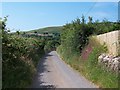
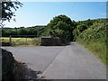
2
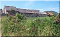
Cae Newydd from the Mochras Farm road
Cae Newydd and the adjacent disused farm buildings are here viewed across a meadow.
Image: © Eric Jones
Taken: 25 Jun 2010
0.01 miles
3
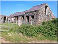
Picturesque farm ruins at Cae Newydd
Cae Newydd (= new field) lies in the shadow of the distinctive Carn Fadryn hill. Cae Newydd is another victim of farm amalgamation.
Image: © Eric Jones
Taken: 25 Jun 2010
0.01 miles
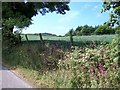
4
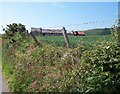
Hedgerow flowers near the ruined Cae-newydd farm buildings
Image: © Eric Jones
Taken: 25 Jun 2010
0.04 miles
5
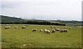
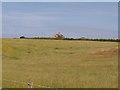
Grazing sheep at Mochras Farm
The isolated hill in the middle ground right is Moelypenmaen Image
Image: © Eric Jones
Taken: 25 Jun 2010
0.06 miles
7
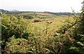
Sheep pastures above Cors Geirch marshland
Image: © Eric Jones
Taken: 25 Jun 2010
0.08 miles
8
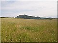
Hay meadow at Mochras
Carn Boduan and the Eifl Hills form the background.
Image: © Eric Jones
Taken: 25 Jun 2010
0.09 miles
10
Crop field south of Coed Mynydd-Meilian
Image: © Eric Jones
Taken: 25 Jun 2010
0.12 miles