
IMAGES TAKEN NEAR TO
Garnfadryn, PWLLHELI, LL53 8TG
Introduction
This page details the photographs taken nearby to LL53 8TG by members of the Geograph project.
The Geograph project started in 2005 with the aim of publishing, organising and preserving representative images for every square kilometre of Great Britain, Ireland and the Isle of Man.

There are currently over 7.5m images from over14,400 individuals and you can help contribute to the project by visiting https://www.geograph.org.uk
Image Map
Images are licensed for reuse under creativecommons.org/licenses/by-sa/2.0
Notes
- Clicking on the map will re-center to the selected point.
- The higher the marker number, the further away the image location is from the centre of the postcode.
Image Listing (24 Images Found)
Images are licensed for reuse under creativecommons.org/licenses/by-sa/2.0
Image
Details
Distance
1

Dispersed settlement at Garnfadryn
This is an area of small holdings created in the early 19thC from reclaimed parts of the Garn Fadryn Common.The view is taken from the Groeslon (crossroads).
Image: © Eric Jones
Taken: 5 Aug 2010
0.11 miles
2

Former village store, Garnfadryn
The section of the house on the right operated as a village stores into the 1990's.
Image: © Trevor Harris
Taken: 14 Apr 2012
0.12 miles


6

Road west from Groeslon Garnfadryn towards the Llaniestyn road
The wooded Cefnamwlch hill can be seen in the background. It overlooks the mansion of Cefnamwlch, once the home of Madam Sidney Griffith who became infatuated with Howell Harris, the early Welsh Calvinistic leader and left her rarely sober brute of a husband, Squire William Griffith, to cohabit with the married Harris at his religious community at Trevecca in Breconshire.
Image: © Eric Jones
Taken: 5 Aug 2010
0.16 miles
7
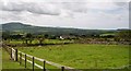
View southwards from the hamlet of Garnfadryn
In the background Mynydd Rhiw can be seen on the left, Mynydd Anelog and Mynydd Enlli in the centre and Mynydd Cefnamwlch on the right.
Image: © Eric Jones
Taken: 5 Aug 2010
0.17 miles
8

Dispersed settlements in the hamlet of Garnfadryn
Image: © Eric Jones
Taken: 5 Aug 2010
0.17 miles
9

Land regression above Garnfadryn
These marginal fields laboriously reclaimed from the upland in the 19thC, were never of great economic value. Even so, they provided crops of hay. Today, with more extensive forms of pastoral farming they are used mainly as rough grazings for sheep and little effort is made to check the advance of bracken and thistles.
Image: © Eric Jones
Taken: 5 Aug 2010
0.17 miles
10

Garnfadryn Chapel
Looking south east. The school bus is parked on the left.
Image: © David Medcalf
Taken: 14 Jun 2006
0.17 miles