IMAGES TAKEN NEAR TO
Rhoshirwaun, PWLLHELI, LL53 8HU
Introduction
This page details the photographs taken nearby to LL53 8HU by members of the Geograph project.
The Geograph project started in 2005 with the aim of publishing, organising and preserving representative images for every square kilometre of Great Britain, Ireland and the Isle of Man.

There are currently over 7.5m images from over14,400 individuals and you can help contribute to the project by visiting https://www.geograph.org.uk
Image Map
Images are licensed for reuse under creativecommons.org/licenses/by-sa/2.0
Notes
- Clicking on the map will re-center to the selected point.
- The higher the marker number, the further away the image location is from the centre of the postcode.
Image Listing (15 Images Found)
Images are licensed for reuse under creativecommons.org/licenses/by-sa/2.0
Image
Details
Distance
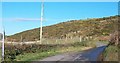
2
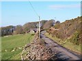
Ffordd wledig/Country road near Meillionydd
Image: © Eric Jones
Taken: 20 Nov 2010
0.05 miles
3
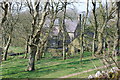
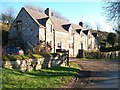
Ffermdy Meillionydd Farmhouse
This was built as a home for minor gentry, generations of whom played an important role in the administration of the district and indeed of the County of Caernarfon. A John Williams of Meillionydd was Sheriff of Caernarfonshire during the later years of Cromwell's rule.
http://www.rhiw.com/hanes_02/adeiladau/meillionydd/meillionydd_fawr.htm
Image: © Eric Jones
Taken: 20 Nov 2010
0.06 miles
4
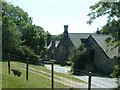
Stablau Meillionydd
These as the name suggests are the converted stables of Meillionydd Mawr.
Image: © Eric Jones
Taken: 20 Nov 2010
0.06 miles
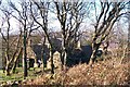
6
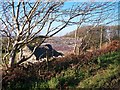
Field barns at Meillionnydd
Such barns are agriculturally less important than in the past. At Meillionydd they have been replaced by modern sheds.
Image: © Eric Jones
Taken: 20 Nov 2010
0.07 miles
7
Field barns at Meillionydd Mawr farm
These barns, no longer fit for the purposes of modern agriculture, have been replaced by large metal sheds.
Image: © Eric Jones
Taken: 20 Nov 2010
0.07 miles
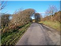
8
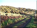
Public footpath leading on to Mynydd Rhiw
This footpath starts behind Meillionydd Mawr farmhouse.
Image: © Eric Jones
Taken: 20 Nov 2010
0.08 miles
9
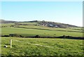
Meillionydd Mawr Farm and Mynydd Rhiw from Lon Cae Graig
Image: © Eric Jones
Taken: 20 Nov 2010
0.10 miles