IMAGES TAKEN NEAR TO
Rhoshirwaun, PWLLHELI, LL53 8HS
Introduction
This page details the photographs taken nearby to LL53 8HS by members of the Geograph project.
The Geograph project started in 2005 with the aim of publishing, organising and preserving representative images for every square kilometre of Great Britain, Ireland and the Isle of Man.

There are currently over 7.5m images from over14,400 individuals and you can help contribute to the project by visiting https://www.geograph.org.uk
Image Map (Loading...)


Getting Data...Please wait
Leaflet Map data © OpenStreetMap
Images are licensed for reuse under creativecommons.org/licenses/by-sa/2.0
Notes
- Clicking on the map will re-center to the selected point.
- The higher the marker number, the further away the image location is from the centre of the postcode.
Image Listing (8 Images Found)
Images are licensed for reuse under creativecommons.org/licenses/by-sa/2.0
Image
Details
Distance
1
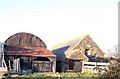
Farm buildings at Plasnewydd
These are still used for agriculatural purposes.
Image: © Eric Jones
Taken: 20 Nov 2010
0.01 miles
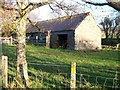
2
Traditional farm buildings at Plasnewydd
Image: © Eric Jones
Taken: 20 Nov 2010
0.05 miles
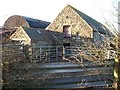
4
The farmhouse at Plasnewydd
This former 18thC farmhouse has been converted into luxury holiday accommodation.
http://www.cleanaircottages.com/property?id=318L
Image: © Eric Jones
Taken: 20 Nov 2010
0.07 miles
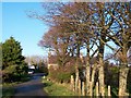
5
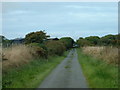
The road to Plasnewydd
Plasnewydd farm buildings are visible. The road passes through the farm and cottages, towards Pen-y-groeslon.
Image: © David Medcalf
Taken: 22 Aug 2006
0.08 miles
6
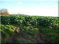
A field of brassicas near Plasnewydd
This is grown as a fodder crop.
Image: © Eric Jones
Taken: 20 Nov 2010
0.12 miles
7
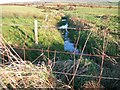
Nant Meillionydd Mawr near Pyllau Peiriannau
Pyllau peiriannau means "machine pools".
Image: © Eric Jones
Taken: 20 Nov 2010
0.18 miles
8
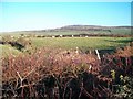
Farmland north of the Felin Uchaf Road
Meillionydd Mawr farm can be seen in the background.
Image: © Eric Jones
Taken: 20 Nov 2010
0.21 miles