
IMAGES TAKEN NEAR TO
Rhoshirwaun, PWLLHELI, LL53 8HH
Introduction
This page details the photographs taken nearby to LL53 8HH by members of the Geograph project.
The Geograph project started in 2005 with the aim of publishing, organising and preserving representative images for every square kilometre of Great Britain, Ireland and the Isle of Man.

There are currently over 7.5m images from over14,400 individuals and you can help contribute to the project by visiting https://www.geograph.org.uk
Image Map
Images are licensed for reuse under creativecommons.org/licenses/by-sa/2.0
Notes
- Clicking on the map will re-center to the selected point.
- The higher the marker number, the further away the image location is from the centre of the postcode.
Image Listing (8 Images Found)
Images are licensed for reuse under creativecommons.org/licenses/by-sa/2.0
Image
Details
Distance
1
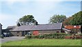
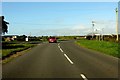
Former cottages at Y Fantol farm
The present farmhouse lies immediately west of these converted cottages.
Image: © Eric Jones
Taken: 1 Sep 2010
0.10 miles
6
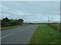
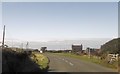
Junction on the B4413
Looking north east, along the B4413. The minor road to Rhydlios joins from the left.
Image: © David Medcalf
Taken: 22 Aug 2006
0.11 miles
7
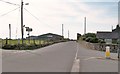
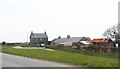
The Pen-y-groeslon Depot of Wynnstay Agricultural Merchants
This depot is located alongside the B4413
Image: © Eric Jones
Taken: 1 Sep 2010
0.17 miles
8
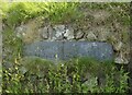
Old Milestone by B4413/B4417 junction, Penygroeslon
Milestone by the B4413, in parish of Botwnnog (Gwynedd District). On the verge set into a wall. Erected in the 19th century.
Inscription reads:-
MILES
TO RHIW 3 {hand right}
TO LLANFAELFHYS 2
To be surveyed
Milestone Society National ID: CAE_PWAD13C
Image: © Christopher Leather
Taken: 1 Aug 2024
0.25 miles