
IMAGES TAKEN NEAR TO
Aberdaron, PWLLHELI, LL53 8BH
Introduction
This page details the photographs taken nearby to LL53 8BH by members of the Geograph project.
The Geograph project started in 2005 with the aim of publishing, organising and preserving representative images for every square kilometre of Great Britain, Ireland and the Isle of Man.

There are currently over 7.5m images from over14,400 individuals and you can help contribute to the project by visiting https://www.geograph.org.uk
Image Map
Images are licensed for reuse under creativecommons.org/licenses/by-sa/2.0
Notes
- Clicking on the map will re-center to the selected point.
- The higher the marker number, the further away the image location is from the centre of the postcode.
Image Listing (28 Images Found)
Images are licensed for reuse under creativecommons.org/licenses/by-sa/2.0
Image
Details
Distance


3

Ty Fferm Bodernabwy Farmhouse, Aberdaron
Bodernabwy means the dwelling place (bod) of Ernabwy. Who Ernabwy was, Google does not recall.
Image: © Eric Jones
Taken: 2 Nov 2007
0.01 miles
4

View across the Cyllyfelin Valley towards Bodernabwy Farmhouse
The twin towers of the "new" Anglican church can be seen behind the farm buildings. The house on the left is the former Police Station. There is a photo of P.C.Evans of Aberdaron in the 1960s on the following link.
http://www.rhiw.com/hen_luniau_pages/aberdaron/aberdaron_04/evans_plisman.jpg
Image: © Eric Jones
Taken: 2 Nov 2007
0.02 miles
5

Fferm Bodernabwy and Eglwys Newydd from Fferm Gwythrian
Both farm and church overlook the incised valley of Afon Cyllyfelin. The house to the left of the church is Ty'r Heddlu - the former Aberdaron police station. The nearest police stations to Aberdaron today are Nefyn and Pwllheli, but the district is well policed by mobile patrols.
Image
Image: © Eric Jones
Taken: 27 Oct 2010
0.07 miles
6
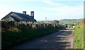
The inland road to Uwchmynydd
This road passes the new Anglican church of 1841, seen on the left. This rather ugly building was disused, except for funeral services, in the 1860s.
Image: © Eric Jones
Taken: 27 Oct 2010
0.07 miles
7

Ordnance Survey Cut Mark
This OS cut mark can be found on the SW face of the Church. It marks a point 47.742m above mean sea level.
Image: © Adrian Dust
Taken: 30 Mar 2016
0.07 miles
8

Eglwys Newydd in Aberdaron
Dark old church on Lleyn.
Image: © Jeremy Bolwell
Taken: 25 May 2015
0.08 miles
9

The Cyllyfelin valley from the bridge
Afon Cyllyfelin which drains this valley means "stream that flows through the hazel trees by the mill"
Image: © Eric Jones
Taken: 2 Nov 2007
0.08 miles
10

Staggered crossroads near Eglwys Newydd
Both the road ahead and that to the right lead to the B4413. The road on the left leads north towards Rhydlios. The Bro Hywyn estate stands on the skyline.
Image: © Eric Jones
Taken: 27 Oct 2010
0.09 miles