
IMAGES TAKEN NEAR TO
Rhiw, PWLLHELI, LL53 8AU
Introduction
This page details the photographs taken nearby to LL53 8AU by members of the Geograph project.
The Geograph project started in 2005 with the aim of publishing, organising and preserving representative images for every square kilometre of Great Britain, Ireland and the Isle of Man.

There are currently over 7.5m images from over14,400 individuals and you can help contribute to the project by visiting https://www.geograph.org.uk
Image Map
Images are licensed for reuse under creativecommons.org/licenses/by-sa/2.0
Notes
- Clicking on the map will re-center to the selected point.
- The higher the marker number, the further away the image location is from the centre of the postcode.
Image Listing (47 Images Found)
Images are licensed for reuse under creativecommons.org/licenses/by-sa/2.0
Image
Details
Distance


3
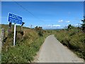
Unsuitable for wide vehicles
Like many roads in this area.
Image: © David Medcalf
Taken: 21 Jun 2018
0.13 miles
4

Mynydd Rhiw
The radar tracking station can be seen next to the boss of volcanic rock.
Image: © Eric Jones
Taken: 2 Nov 2007
0.15 miles
5

Gorse covered slope below the Rhiw radar station
This area of frith is a designated area of Special Scientific Interest.
Image: © Eric Jones
Taken: 16 Nov 2007
0.16 miles
6

Miners' path from Benallt Mine to the village of Rhiw
Image: © Eric Jones
Taken: 9 Nov 2007
0.16 miles
7

Volcanic boss on Mynydd Rhiw
An MOD sponsored radar station is situated next to the boss.
Image: © Eric Jones
Taken: 27 Oct 2010
0.17 miles
8

The Rhiw radar and radio relay station complex
Image: © Eric Jones
Taken: 16 Nov 2007
0.17 miles
9

The Mynydd Rhiw MOD radar tracking station viewed from the village
Fears have been expressed in certain quarters that the electrical emissions from this station could have a detrimental effect on the health of the villagers.
Image: © Eric Jones
Taken: 9 Nov 2007
0.17 miles
10

View downslope towards the Benallt manganese mine
Image: © Eric Jones
Taken: 16 Nov 2007
0.18 miles