
IMAGES TAKEN NEAR TO
Rhydyclafdy, PWLLHELI, LL53 7YR
Introduction
This page details the photographs taken nearby to LL53 7YR by members of the Geograph project.
The Geograph project started in 2005 with the aim of publishing, organising and preserving representative images for every square kilometre of Great Britain, Ireland and the Isle of Man.

There are currently over 7.5m images from over14,400 individuals and you can help contribute to the project by visiting https://www.geograph.org.uk
Image Map
Images are licensed for reuse under creativecommons.org/licenses/by-sa/2.0
Notes
- Clicking on the map will re-center to the selected point.
- The higher the marker number, the further away the image location is from the centre of the postcode.
Image Listing (13 Images Found)
Images are licensed for reuse under creativecommons.org/licenses/by-sa/2.0
Image
Details
Distance
2
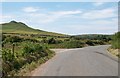
Minor road junction on the B4415 near Bryn Bach
The minor road on the left leads to Llanfihangel Bachellaeth.
Image: © Eric Jones
Taken: 25 Jun 2010
0.07 miles
3
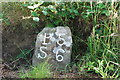
Carreg filltir - Milestone
One of a series of "minimalist" stones on the old road from Pwllheli to Aberdaron. Here S stands for Sarn Meyllteyrn.
Image: © Alan Fryer
Taken: 29 Jul 2007
0.08 miles
4

The view northwards from the graveyard at Llanfihangel Bachellaeth
The farm in the centre ground is Bryn Bach and the nearby woodland is Coed Bodgadle. The North Irish Sea can be seen in the background.
Image: © Eric Jones
Taken: 25 Jun 2010
0.08 miles
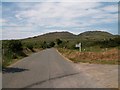
6
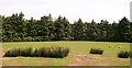
Coed Bodgadle woodland
This block of woodland is here viewed across sheep pastures.
Image: © Eric Jones
Taken: 25 Jun 2010
0.15 miles
7
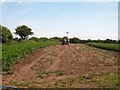
Partly harvested potato field at Bryn Bach
Image: © Eric Jones
Taken: 25 Jun 2010
0.16 miles
9
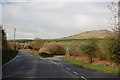
Road junction near Garnfadryn
Both roads lead to Botwnnog, the one on the right via Garnfadryn.
Image: © Trevor Harris
Taken: 8 Apr 2012
0.20 miles
10
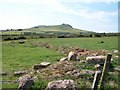
View south along the Horon Valley with Carn Seithon in the background
Image: © Eric Jones
Taken: 25 Jun 2010
0.21 miles