
IMAGES TAKEN NEAR TO
Botwnnog, PWLLHELI, LL53 7SW
Introduction
This page details the photographs taken nearby to LL53 7SW by members of the Geograph project.
The Geograph project started in 2005 with the aim of publishing, organising and preserving representative images for every square kilometre of Great Britain, Ireland and the Isle of Man.

There are currently over 7.5m images from over14,400 individuals and you can help contribute to the project by visiting https://www.geograph.org.uk
Image Map
Images are licensed for reuse under creativecommons.org/licenses/by-sa/2.0
Notes
- Clicking on the map will re-center to the selected point.
- The higher the marker number, the further away the image location is from the centre of the postcode.
Image Listing (8 Images Found)
Images are licensed for reuse under creativecommons.org/licenses/by-sa/2.0
Image
Details
Distance
2
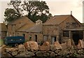
Traditional farm buildings at Talsarn Farm
Talsarn means "by the road".
Image: © Eric Jones
Taken: 1 Sep 2010
0.04 miles
4
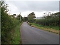
Pont Talsarn bridge between Talsarn Farm and Seithbont
Pont Talsarn spans Afon Horon, a tributary of the Soch.
Image: © Eric Jones
Taken: 2 Oct 2010
0.09 miles
5
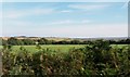
Farmland at Talsarn Farm, Seithbont
This is the view southwards towards the plateau of the Cilan Peninsula.
Image: © Eric Jones
Taken: 1 Sep 2010
0.09 miles
6
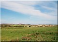
The Soch Valley downstream of Seithbont
The heather clad hills in the background are above Mynytho.
Image: © Eric Jones
Taken: 1 Sep 2010
0.17 miles
7
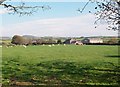
View across farmland to Efail Seithbont
Efail Seithbont (=seventh bridge smithy) was located in the small cottage like structure located next to the two storey house. The former smithy now serves as an office for Dafydd Glyn Jones, distributors of agricultural machinery.
Image: © Eric Jones
Taken: 8 Oct 2010
0.18 miles
8
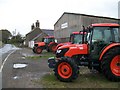
Dafydd Glyn Jones' Agricultural Machinery Distribution Depot, Seithbont
Image: © Eric Jones
Taken: 2 Oct 2010
0.19 miles