IMAGES TAKEN NEAR TO
Mynytho, PWLLHELI, LL53 7SH
Introduction
This page details the photographs taken nearby to LL53 7SH by members of the Geograph project.
The Geograph project started in 2005 with the aim of publishing, organising and preserving representative images for every square kilometre of Great Britain, Ireland and the Isle of Man.

There are currently over 7.5m images from over14,400 individuals and you can help contribute to the project by visiting https://www.geograph.org.uk
Image Map (Loading...)


Getting Data...Please wait
Leaflet Map data © OpenStreetMap
Images are licensed for reuse under creativecommons.org/licenses/by-sa/2.0
Notes
- Clicking on the map will re-center to the selected point.
- The higher the marker number, the further away the image location is from the centre of the postcode.
Image Listing (18 Images Found)
Images are licensed for reuse under creativecommons.org/licenses/by-sa/2.0
Image
Details
Distance
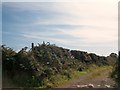
2
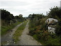
Farm track to Ty Mawr
This farm track leads to Ty mawr (Big House) farm at SH 295 308. The wall corner piece has been there long enough for quite a growth of lichen to establish itself.
Image: © Peter Shone
Taken: 4 Oct 2005
0.08 miles
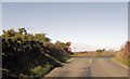
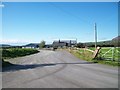
3
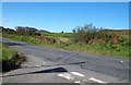
The B4413 from the mouth of the Seithbont road
Image: © Eric Jones
Taken: 25 Sep 2010
0.09 miles
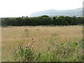
7
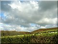
Sheep on farmland below Cytir Mynytho Common
Image: © Eric Jones
Taken: 9 Nov 2007
0.17 miles
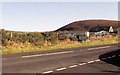
9
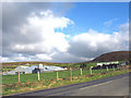
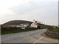
Farm buildings alongside the B4413 on the western outskirts of Mynytho
Image: © Eric Jones
Taken: 9 Nov 2007
0.17 miles