
IMAGES TAKEN NEAR TO
Penrhos, PWLLHELI, LL53 7NE
Introduction
This page details the photographs taken nearby to LL53 7NE by members of the Geograph project.
The Geograph project started in 2005 with the aim of publishing, organising and preserving representative images for every square kilometre of Great Britain, Ireland and the Isle of Man.

There are currently over 7.5m images from over14,400 individuals and you can help contribute to the project by visiting https://www.geograph.org.uk
Image Map
Images are licensed for reuse under creativecommons.org/licenses/by-sa/2.0
Notes
- Clicking on the map will re-center to the selected point.
- The higher the marker number, the further away the image location is from the centre of the postcode.
Image Listing (10 Images Found)
Images are licensed for reuse under creativecommons.org/licenses/by-sa/2.0
Image
Details
Distance
2
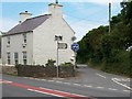
The road to Penrhos village and the backroad to Poland
This unclassified road leaving the A499 leads to Penrhos village and on by a track to the Polskie Osiedle Penrhos situated at the former RAF Penrhos.
http://www.phsltd.org/aboutus_pl.asp
Image: © Eric Jones
Taken: 17 Jun 2010
0.03 miles
3
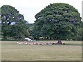
Who ever said sheep are stupid animals?
Sheltering from the mid-summer sun below the trees, these sheep are more sensible than humans give them credit for.
Image: © Eric Jones
Taken: 17 Jun 2010
0.05 miles
4
Woodland and rough pasture between Penrhos and Pwllheli
Image: © Eric Jones
Taken: 25 Jun 2010
0.12 miles
6
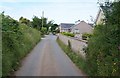
Bungalows on the eastern side of the hamlet of Penrhos
Image: © Eric Jones
Taken: 17 Jun 2010
0.15 miles
7
Access road to the A499
This road is classified as "other route with public access".
Image: © Eric Jones
Taken: 17 Jun 2010
0.18 miles
8
Cattle grazing on the flood plain of Afon Rhyd-hir
Image: © Eric Jones
Taken: 27 Oct 2010
0.19 miles
9
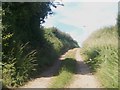
Track leading north from the A499 towards the Stad Cynfil Housing Estate
This provides a quick access to the bus route. A bus shelter stands at the A499 end of the track.
Image: © Eric Jones
Taken: 25 Jun 2010
0.22 miles
10
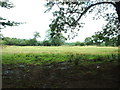
Farmland near Plas-ym-mhenrhos
Looking north, on the opposite side of the A499 to PYM.
Image: © David Medcalf
Taken: 22 Aug 2006
0.23 miles