
IMAGES TAKEN NEAR TO
Llithfaen, PWLLHELI, LL53 6NN
Introduction
This page details the photographs taken nearby to LL53 6NN by members of the Geograph project.
The Geograph project started in 2005 with the aim of publishing, organising and preserving representative images for every square kilometre of Great Britain, Ireland and the Isle of Man.

There are currently over 7.5m images from over14,400 individuals and you can help contribute to the project by visiting https://www.geograph.org.uk
Image Map
Images are licensed for reuse under creativecommons.org/licenses/by-sa/2.0
Notes
- Clicking on the map will re-center to the selected point.
- The higher the marker number, the further away the image location is from the centre of the postcode.
Image Listing (47 Images Found)
Images are licensed for reuse under creativecommons.org/licenses/by-sa/2.0
Image
Details
Distance
1
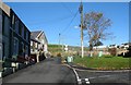
The road to the Mynydd Gwaith and Nant Gwtheyrn Quarries
Before WWII, six days a week, this road would be full of quarrymen going to and coming from their work at the nearby granite quarries.
Image: © Eric Jones
Taken: 16 Oct 2010
0.02 miles
2
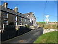
Terraced houses and the former Capel Tabor on Ffordd y Nant
Tabor dates back to 1885 and was a Welsh Baptist chapel. It was converted into a house around 2003.
http://www.peoplescollectionwales.co.uk/item/15598-tabor-chapel-bapt-llithfaen-which-opened-in-1?Casgliad.Lang=cym
Image: © Eric Jones
Taken: 16 Oct 2010
0.02 miles
4
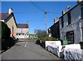
View north towards Y Groes at Llithfaen
Y Groes is the crossroads at the centre of the village.
Image: © Eric Jones
Taken: 16 Oct 2010
0.03 miles
5
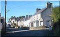
Liverpool Terrace, Llithfaen
These are late Victorian quarrymen's cottages.
Image: © Eric Jones
Taken: 16 Oct 2010
0.03 miles
6
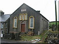
Capel Tabor
It looks disused and there is no indication of what denomination it served.
Image: © Dewi
Taken: 24 Feb 2007
0.03 miles
7
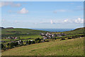
Pistyll: towards Llithfaen and Caernarfon Bay
View west-south-west from a footpath above the B4417 road, at SH367435
Image: © Martin Bodman
Taken: 17 Sep 2005
0.04 miles
8
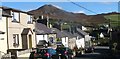
View east along Liverpool Terrace, Llithfaen
Image: © Eric Jones
Taken: 16 Oct 2010
0.04 miles
9
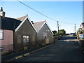
Y Ganolfan Llithfaen Community Centre
This is located in the old primary school building. Lithfaen children now attend Ysgol Gynradd Pentreuchaf school.
Image
Image: © Eric Jones
Taken: 16 Oct 2010
0.04 miles
10
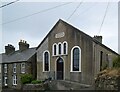
Capel Tabor, Llithfaen
Built 1885, see Coflein record 7091: https://coflein.gov.uk/en/site/7091?term=llithfaen .
Image: © Bill Harrison
Taken: 6 Jul 2023
0.04 miles