
IMAGES TAKEN NEAR TO
Llannor, PWLLHELI, LL53 6DW
Introduction
This page details the photographs taken nearby to LL53 6DW by members of the Geograph project.
The Geograph project started in 2005 with the aim of publishing, organising and preserving representative images for every square kilometre of Great Britain, Ireland and the Isle of Man.

There are currently over 7.5m images from over14,400 individuals and you can help contribute to the project by visiting https://www.geograph.org.uk
Image Map
Images are licensed for reuse under creativecommons.org/licenses/by-sa/2.0
Notes
- Clicking on the map will re-center to the selected point.
- The higher the marker number, the further away the image location is from the centre of the postcode.
Image Listing (19 Images Found)
Images are licensed for reuse under creativecommons.org/licenses/by-sa/2.0
Image
Details
Distance
1
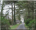
Driveway to the blocked gate passage at Bodvel Hall
This house was once the gatehouse to a much larger mansion. In the 18th century the main house was demolished and the gatehouse converted into a dwelling. The gate passage became an entrance hall with an ornate stairway to the first floor.
Image
Image: © Eric Jones
Taken: 30 Jan 2008
0.01 miles
2
Bodvel Hall - a house with an interesting history
Image: © Eric Jones
Taken: 30 Jan 2008
0.01 miles
3
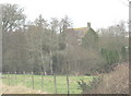
Bodvel Hall - a converted gatehouse
This is a much modified early 17thC three storey house which was originally the gatehouse to a larger building. It was in the 18th century that the main house was demolished and the gatehouse converted into a dwelling, the gate passage being blocked by a stairway.
The Bodfel (later Bodvel) family first came to prominence with John Wyn ap Hugh who as Northumberland's standard bearer at the crushing of the Ket's rebellion was rewarded with land and offices. Given the lands of Bardsey Abbey, he used the island to run a major piracy and smuggling operation while holding the office of county commissioner for the suppression of piracy and smuggling. In the reign of Elizabeth, the family's loyalty to the Old Faith led to an eclipse in its fortunes.
In the 1660s Col John Bodvel, a Royalist, who had been was a member of both the Long and Short Parliaments, died and the estate passed to Charles Bodvel Robartes (2nd Earl of Radnor). The house, once the centre of Catholic recusance in this part of Llyn was then licensed for Dissenting worship and the house occupied by the controversial Presbyterian divine James Owen. His congregation was not particularly numerous - three genuine worshippers and two government spies.
In the 18thC Bodfel passed to the Salusburys of Bachygraig in Flintshire and was the birthplace and, later, marital home of the precocious Hester Lynch Salusbury, (later Mrs Thrale and later still Mrs Piozzi), a friend of Samuel Johnson.
In the 19thC, the house, by then occupied by tenant farmers, was much modernised.
http://yba.llgc.org.uk/en/s-BODV-EL0-1550.html
http://yba.llgc.org.uk/en/s-PIOZ-LYN-1741.html
Image: © Eric Jones
Taken: 30 Jan 2008
0.02 miles
5
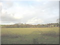
View across farmland in the direction of Bodvel Hall Farm
Image: © Eric Jones
Taken: 5 Jan 2008
0.09 miles

7
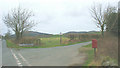
The entrance to the Gwnhinger road from the A497
Image: © Eric Jones
Taken: 30 Jan 2008
0.12 miles
8
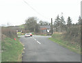
Bodfel Crossroads
Here the minor roads northwards from the direction of Cae Mine, and southwards from Gwnhinger meet the A497 Nefyn to Pwllheli road.
Image: © Eric Jones
Taken: 30 Jan 2008
0.13 miles
10

Bodfel Bach
This house was built as a yeoman farmer's residence in the 17thC.
Image: © Eric Jones
Taken: 30 Jan 2008
0.17 miles