
IMAGES TAKEN NEAR TO
Penrhos, PWLLHELI, LL53 6BH
Introduction
This page details the photographs taken nearby to Penrhos, LL53 6BH by members of the Geograph project.
The Geograph project started in 2005 with the aim of publishing, organising and preserving representative images for every square kilometre of Great Britain, Ireland and the Isle of Man.

There are currently over 7.5m images from over14,400 individuals and you can help contribute to the project by visiting https://www.geograph.org.uk
Image Map
Images are licensed for reuse under creativecommons.org/licenses/by-sa/2.0
Notes
- Clicking on the map will re-center to the selected point.
- The higher the marker number, the further away the image location is from the centre of the postcode.
Image Listing (103 Images Found)
Images are licensed for reuse under creativecommons.org/licenses/by-sa/2.0
Image
Details
Distance
2
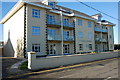
Tywod Arian Morfa Nefyn
A new development of luxury holiday apartments, completely out of scale with the surrounding village.
Image: © Alan Fryer
Taken: 28 Oct 2007
0.03 miles
3
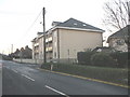
The incongruous Tywod Arian apartment block
This is one of two adjoining luxury apartment blocks plonked down amidst nineteenth century workers cottages.
Image: © Eric Jones
Taken: 19 Dec 2007
0.06 miles
4
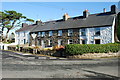
Hen Fythynnod Morfa Nefyn Old Cottages
Although much renovated, the cottages show a more traditional aspect of the village than Image across the lane.
Image: © Alan Fryer
Taken: 28 Oct 2007
0.06 miles
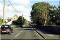
6
The Penrhos area of Morfa Nefyn
Morfa Nefyn is a village which originated in the 18th century and expanded during the 20th. The two large buildings on the right are recently built blocks of apartments.
Image: © Eric Jones
Taken: 5 Jan 2008
0.08 miles
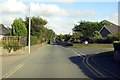
8
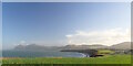
Morfa Nefyn
The village and beach of Morfa Nefyn, with in the distance Yr Eifl hills; the visible peaks are (L to R): Garn For (446m), Garn Ganol (561 metres), Tre'r Ceiri (489m) and Caer Gribin (374m). Ref:PC210018a.
Porthdinllaen
Image: © Phil Brandon Hunter
Taken: 21 Dec 2022
0.12 miles
10
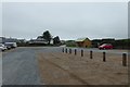
Car park at Morfa Nefyn
National Trust car park on top of the cliffs.
Image: © DS Pugh
Taken: 3 Aug 2018
0.12 miles