IMAGES TAKEN NEAR TO
Ala Road, PWLLHELI, LL53 5TA
Introduction
This page details the photographs taken nearby to Ala Road, LL53 5TA by members of the Geograph project.
The Geograph project started in 2005 with the aim of publishing, organising and preserving representative images for every square kilometre of Great Britain, Ireland and the Isle of Man.

There are currently over 7.5m images from over14,400 individuals and you can help contribute to the project by visiting https://www.geograph.org.uk
Image Map
Images are licensed for reuse under creativecommons.org/licenses/by-sa/2.0
Notes
- Clicking on the map will re-center to the selected point.
- The higher the marker number, the further away the image location is from the centre of the postcode.
Image Listing (32 Images Found)
Images are licensed for reuse under creativecommons.org/licenses/by-sa/2.0
Image
Details
Distance
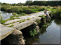
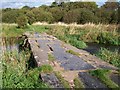
2
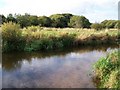
Afon Rhyd-hir below Pont y Garreg-fychan
Image: © Eric Jones
Taken: 25 Sep 2010
0.06 miles
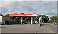
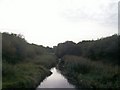
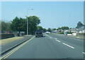
4
The busy Pont y Garreg-fechan roundabout
The "garreg-fechan" (=small rock) can be seen to the right of the image.
Image: © Eric Jones
Taken: 25 Sep 2010
0.07 miles
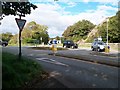
10
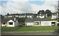
New bungalows on the western approach to the town
Image: © Eric Jones
Taken: 9 Nov 2007
0.10 miles