IMAGES TAKEN NEAR TO
Abererch Road, PWLLHELI, LL53 5LT
Introduction
This page details the photographs taken nearby to Abererch Road, LL53 5LT by members of the Geograph project.
The Geograph project started in 2005 with the aim of publishing, organising and preserving representative images for every square kilometre of Great Britain, Ireland and the Isle of Man.

There are currently over 7.5m images from over14,400 individuals and you can help contribute to the project by visiting https://www.geograph.org.uk
Image Map (Loading...)


Getting Data...Please wait
Leaflet Map data © OpenStreetMap
Images are licensed for reuse under creativecommons.org/licenses/by-sa/2.0
Notes
- Clicking on the map will re-center to the selected point.
- The higher the marker number, the further away the image location is from the centre of the postcode.
Image Listing (166 Images Found)
Images are licensed for reuse under creativecommons.org/licenses/by-sa/2.0
Image
Details
Distance
1
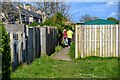
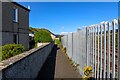
Pwllheli : Footpath
A path to Abererch Road.
Image: © Lewis Clarke
Taken: 20 Apr 2024
0.01 miles
2
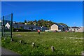
Pwllheli : Play Area
A field and playground.
Image: © Lewis Clarke
Taken: 20 Apr 2024
0.04 miles
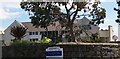
3
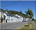
Cottages on the Porthmadog road, Pwllheli
Image: © Bill Harrison
Taken: 9 Jul 2022
0.04 miles
4
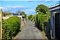
Pwllheli : Abererch Road
A small lane around the back of houses.
Image: © Lewis Clarke
Taken: 20 Apr 2024
0.05 miles
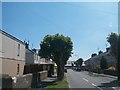
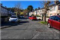
7
Nineteenth century terraced houses and twentieth century Council Houses on Abererch Road
Image: © Eric Jones
Taken: 25 Jun 2010
0.06 miles
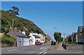
8
Pwllheli : Ffordd-Y-Maer
Looking off the A497.
Image: © Lewis Clarke
Taken: 19 Apr 2024
0.06 miles
9
Pwllheli : Footpath
A footpath off Ffordd-Y-Maer to the park.
Image: © Lewis Clarke
Taken: 20 Apr 2024
0.06 miles
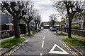
10
Pwllheli : Ffordd-Y-Maer
Looking along Ffordd-Y-Maer.
Image: © Lewis Clarke
Taken: 20 Apr 2024
0.07 miles