
IMAGES TAKEN NEAR TO
New Street, PWLLHELI, LL53 5HP
Introduction
This page details the photographs taken nearby to New Street, LL53 5HP by members of the Geograph project.
The Geograph project started in 2005 with the aim of publishing, organising and preserving representative images for every square kilometre of Great Britain, Ireland and the Isle of Man.

There are currently over 7.5m images from over14,400 individuals and you can help contribute to the project by visiting https://www.geograph.org.uk
Image Map
Images are licensed for reuse under creativecommons.org/licenses/by-sa/2.0
Notes
- Clicking on the map will re-center to the selected point.
- The higher the marker number, the further away the image location is from the centre of the postcode.
Image Listing (524 Images Found)
Images are licensed for reuse under creativecommons.org/licenses/by-sa/2.0
Image
Details
Distance
1
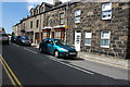
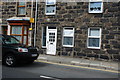
L?n Dywod Pwllheli
Lôn Dywod leads from Stryd Fawr to the railway station. Its name (Sand Street) is a reminder of how much closer the sea was to the town in past centuries.
This busy road is the main way out of town to the roads to Caernarfon and Porthmadog, and so carries constant heavy traffic.
The house at the right of the picture is called Sŵn y Lôn (road noise) - a light-hearted play on more common house names such as Sŵn y Môr (sound of the sea) or Sŵn y Don (sound of the wave).
Image: © Alan Fryer
Taken: 10 Aug 2008
0.01 miles
2
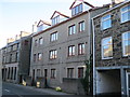
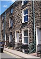
Safle Capel Seion - The site of Seion Chapel
These flats stand on the site of the Methodist chapel, which now holds services in the original vestry behind the flats.
Image: © Alan Fryer
Taken: 15 Oct 2013
0.02 miles
3
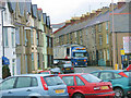
A tight squeeze in Lon Dywod
Lon Dywod is part of the A499 through the centre of Pwllheli
Image: © Eric Jones
Taken: 30 Jan 2008
0.02 miles
4
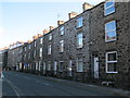
L?n Dywod
The road out of Pwllheli towards Caernarfon and Porthmadog
Image: © Alan Fryer
Taken: 15 Oct 2013
0.02 miles
7
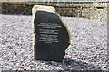
Capel y Drindod Pwllheli
This stone commemorates the renovation of Capel y Drindod in 2008.
The inscription reads:
A stone from Capel Cam Deneio,
the first Calvinistic Methodist chapel
in Pwllheli about 1760.
Capel y Drindod settled here
during the summer of 2008
following extensive renovations.
The present chapel was built on the Penmount site in 1841
and substantially rebuilt in 1881.
"What mean ye by these stones?"
Joshua 4 : 6
Image: © Alan Fryer
Taken: 10 Aug 2008
0.03 miles
8
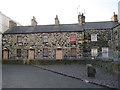
Sgwar Penmount
An L-shaped terrace of grade II listed cottages facing Capel Penmount, now Image
Image: © Alan Fryer
Taken: 4 Dec 2012
0.04 miles
9
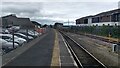
Start of the Cambrian Coast line
The railway line to the wider world at Pwllheli railway station.
Image: © Peter Whatley
Taken: 6 Jun 2022
0.04 miles
10
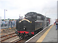
"The Cambrian"
The regular summer steam-hauled excursion trains on the Cambrian Coast line are running again in 2008. Here it is seen leaving Pwllheli on the return trip to Porthmadog and Machynlleth. As there are no turning facilities on the line, the locomotive has to travel tender-first on its return journey.
Image: © John Lucas
Taken: 30 Jul 2008
0.04 miles