
IMAGES TAKEN NEAR TO
Yr Hen Lys, PWLLHELI, LL53 5EN
Introduction
This page details the photographs taken nearby to Yr Hen Lys, LL53 5EN by members of the Geograph project.
The Geograph project started in 2005 with the aim of publishing, organising and preserving representative images for every square kilometre of Great Britain, Ireland and the Isle of Man.

There are currently over 7.5m images from over14,400 individuals and you can help contribute to the project by visiting https://www.geograph.org.uk
Image Map
Images are licensed for reuse under creativecommons.org/licenses/by-sa/2.0
Notes
- Clicking on the map will re-center to the selected point.
- The higher the marker number, the further away the image location is from the centre of the postcode.
Image Listing (408 Images Found)
Images are licensed for reuse under creativecommons.org/licenses/by-sa/2.0
Image
Details
Distance
1
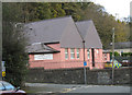
Llysoedd Ynadon Pwllheli Magistrates Court, Troed yr Allt
A dissatisfied 'customer' has painted his/her opinion on the wall.
Image: © Eric Jones
Taken: 10 Nov 2007
0.01 miles
2
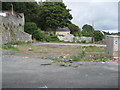
Safle hen Llysoedd yr Ynadon - Site of the former Magistrates' Court
Image was closed at the end of June 2011. The building was demolished and the site is awaiting the construction of six town houses.
Image: © Alan Fryer
Taken: 18 Sep 2015
0.01 miles
3
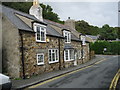
Glan Gors
The old cottage on Pentre Poeth/North Street takes its name from the Cors or pwll heli (salt-water pool) around which the medieval town developed. The name means Marsh Bank.
Image: © Alan Fryer
Taken: 18 Sep 2015
0.01 miles
4
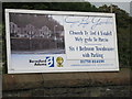
Safle hen Llysoedd yr Ynadon - Site of the former Magistrates' Court
Announcement of the proposed development of Image
Image: © Alan Fryer
Taken: 18 Sep 2015
0.02 miles
5
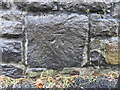
Bench mark in Pentre Poeth/North Street, Pwllheli
This bench mark is at the base of the high wall on the north side of North Street. It is just to the west of the pole carrying the Twmpathau (humps) warning sign. See also Image
Image: © John S Turner
Taken: 5 Nov 2015
0.02 miles
6
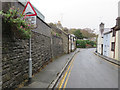
Pentre Poeth/North Street, Pwllheli and a bench mark
Looking north east along North Street below the playground of what is recorded as an Infants School on old maps. There is an Ordnance Survey bench mark on a stone block in the wall this side of the pole carrying the Twmpathau/Humps warning sign - see Image
Image: © John S Turner
Taken: 5 Nov 2015
0.02 miles
7
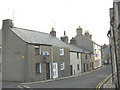
The corner of Pentre Poeth and Stryd Kingshead
Image: © Eric Jones
Taken: 9 Nov 2007
0.02 miles
8
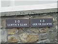
Tŷ tref newydd - New town houses
Ger yr Eglwys refers to the converted Church Hall and Llwyn y Llan to the new town houses.
See Image
Image: © Alan Fryer
Taken: 18 Sep 2015
0.03 miles
10
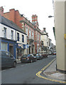
The Hong Kong and Shanghai Banking Corporation Bank, Stryd Fawr, Pwllheli
Before the days of globalization,this used to be the Midland Bank. The shop next door, Babi Bach, caters, as the name implies, for the youngest members of the district's population.
Image: © Eric Jones
Taken: 9 Nov 2007
0.04 miles