
IMAGES TAKEN NEAR TO
Cae Solomon, PWLLHELI, LL53 5AX
Introduction
This page details the photographs taken nearby to Cae Solomon, LL53 5AX by members of the Geograph project.
The Geograph project started in 2005 with the aim of publishing, organising and preserving representative images for every square kilometre of Great Britain, Ireland and the Isle of Man.

There are currently over 7.5m images from over14,400 individuals and you can help contribute to the project by visiting https://www.geograph.org.uk
Image Map
Images are licensed for reuse under creativecommons.org/licenses/by-sa/2.0
Notes
- Clicking on the map will re-center to the selected point.
- The higher the marker number, the further away the image location is from the centre of the postcode.
Image Listing (82 Images Found)
Images are licensed for reuse under creativecommons.org/licenses/by-sa/2.0
Image
Details
Distance
1
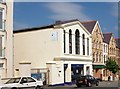
The Assembly Rooms, Cardiff Road
This building is now occupied by a cafe.
Image: © Eric Jones
Taken: 17 Jun 2010
0.03 miles
2
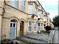
Terrace housing on Cardiff Road
Built with distinctive yellow bricks.
Image: © Oliver Dixon
Taken: 5 Jul 2021
0.04 miles
3
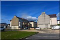
Pwllheli : Heol Hamdden
Houses seen on either side of Heol Hamdden.
Image: © Lewis Clarke
Taken: 21 Apr 2024
0.05 miles
4
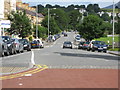
Ffordd Caerdydd Uchaf - Upper Cardiff Road
Image: © Alan Fryer
Taken: 15 Jul 2012
0.06 miles
5
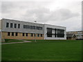
Ysgol Glan y M?r
Pwllheli's 11-16 comprehensive was formed in 1969 by the merger of Ysgol Ramadeg Pwllheli (Grammar School) and Ysgol Frondeg (Secondary Modern School).
Its name, meaning "seashore" is appropriate for its siting close to the promenade.
The school buildings have been refurbished and expanded in the last few years.
Image: © Alan Fryer
Taken: 4 Dec 2011
0.06 miles
6
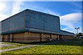
Pwllheli : Byw'n Iach Dwyfor
A leisure centre in Pwlleheli.
Image: © Lewis Clarke
Taken: 21 Apr 2024
0.06 miles
7
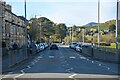
Pwllheli : Cardiff Road
Looking along the road.
Image: © Lewis Clarke
Taken: 21 Apr 2024
0.06 miles
8
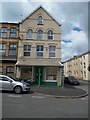
Driving Test Centre, Pwllheli
Located at 33 Cardiff Road LL53 5NT, this driving test centre carries out practical driving tests in the Pwllheli area. A notice indicating that it is a DTC can be seen in the ground floor window to the right of the door, whilst the television aerials at the front of the building are directed towards the TV transmitter at Blaenplwyf, South of Aberystwyth, SN5675 refers. The road to the right of the DTC is named Heol Hamdden, Heol being the Welsh name for Street.
Image: © David Hillas
Taken: 17 Jul 2018
0.06 miles
9
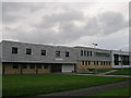
Ysgol Glan y M?r
Pwllheli's 11-16 comprehensive was formed in 1969 by the merger of Ysgol Ramadeg Pwllheli (Grammar School) and Ysgol Frondeg (Secondary Modern School).
Its name, meaning "seashore" is appropriate for its siting close to the promenade.
The school buildings have been refurbished and expanded in the last few years.
Image: © Alan Fryer
Taken: 4 Dec 2011
0.06 miles
10
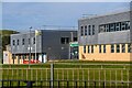
Pwllheli : Ysgol Glan Y Môr
Looking towards the school.
Image: © Lewis Clarke
Taken: 21 Apr 2024
0.07 miles