
IMAGES TAKEN NEAR TO
Rhoslan, CRICCIETH, LL52 0NF
Introduction
This page details the photographs taken nearby to LL52 0NF by members of the Geograph project.
The Geograph project started in 2005 with the aim of publishing, organising and preserving representative images for every square kilometre of Great Britain, Ireland and the Isle of Man.

There are currently over 7.5m images from over14,400 individuals and you can help contribute to the project by visiting https://www.geograph.org.uk
Image Map
Images are licensed for reuse under creativecommons.org/licenses/by-sa/2.0
Notes
- Clicking on the map will re-center to the selected point.
- The higher the marker number, the further away the image location is from the centre of the postcode.
Image Listing (13 Images Found)
Images are licensed for reuse under creativecommons.org/licenses/by-sa/2.0
Image
Details
Distance
5
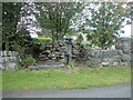
Old water pump and trough
Near Gell Farm on the B4411
Image: © Eirian Evans
Taken: 25 Sep 2021
0.21 miles
7
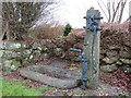
Water pump and stone trough opposite Gell Farm
This old water pump is alongside the B4411 opposite Gell Farm. A well is recorded here at least as far back as 1889, with a pump recorded from 1900. Dick Williams http://www.villagepumps.org.uk/ suggests that the pump is typical of a Joseph Evans design. For a detail of the pump barrel see: Image and for the location: Image
Image: © John S Turner
Taken: 18 Mar 2017
0.23 miles
8
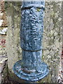
Water pump detail opposite Gell Farm on the B4411
This heavily over-painted casting might be identifiable by a water pump expert, so I will update the description if any information is forthcoming. See also Image
Image: © John S Turner
Taken: 18 Mar 2017
0.23 miles
9
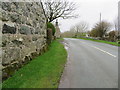
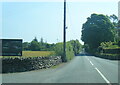
The B4411 at Gell Farm
The Gell Farm building on the left has a moss-covered Ordnance Survey bench mark Image, and across the road near, the telegraph pole, there is an old water pump Image
Image: © John S Turner
Taken: 18 Mar 2017
0.23 miles
10
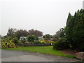
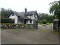
Gell Farm Caravan Park
In the hills above Criccieth
Image: © Eirian Evans
Taken: 25 Sep 2021
0.23 miles