
IMAGES TAKEN NEAR TO
Caernarfon Road, CRICCIETH, LL52 0BG
Introduction
This page details the photographs taken nearby to Caernarfon Road, LL52 0BG by members of the Geograph project.
The Geograph project started in 2005 with the aim of publishing, organising and preserving representative images for every square kilometre of Great Britain, Ireland and the Isle of Man.

There are currently over 7.5m images from over14,400 individuals and you can help contribute to the project by visiting https://www.geograph.org.uk
Image Map
Images are licensed for reuse under creativecommons.org/licenses/by-sa/2.0
Notes
- Clicking on the map will re-center to the selected point.
- The higher the marker number, the further away the image location is from the centre of the postcode.
Image Listing (21 Images Found)
Images are licensed for reuse under creativecommons.org/licenses/by-sa/2.0
Image
Details
Distance
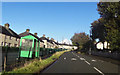
3
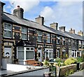
Colourful Criccieth terrace
A very distinctive row of terraced houses made of black, red and yellow bricks.
Image: © Bill Harrison
Taken: 3 Jul 2022
0.12 miles
4
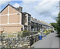
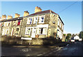
Arvonia Terrace, Criccieth
An interesting mix (from right to left) of two sets of traditional granite terraced cottages, then some very distinctive black, yellow and red brick terraced houses and finally a much taller dwelling at the end. All appear to show on the 1888 OS 6-inch map. Note the lack of pavement.
Image: © Bill Harrison
Taken: 3 Jul 2022
0.12 miles
6
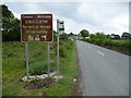
Roadsign on the B4411 north of Criccieth
Some mixed messages here ; someone has taken time to arrange some pebblework but the signage is neglected and cluttered and possibly a bit close to the road edge.
Image: © Jeremy Bolwell
Taken: 13 Jun 2010
0.13 miles
7
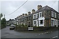
Arfonia Terrace, Criccieth
These are just about the last houses on the B4411 out of Criccieth. Arfonia is 'an ancient name for the region of north-west Gwynedd' and may mean 'opposite Anglesey'.
Image: © Bill Harrison
Taken: 10 Jul 2023
0.13 miles
8
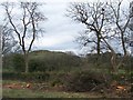
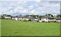
Farmland off the B4411 with Moel Ednyfed in the background
Image: © Eric Jones
Taken: 27 Mar 2010
0.13 miles
9
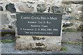
Mynwent Capel Pen-y-maes Burial Ground
In the burial ground of Image] this plaque recordes the opening of the memorial garden.
PEN-Y-MAES MEMORIAL GARDEN
OPENED BY HIS GRACE
THE ARCHBISHOP OF WALES
THE MOST REVEREND
G. O. WILLIAMS. 1980.
"Here are the graves of our fathers"
Image: © Alan Fryer
Taken: 2 May 2010
0.15 miles
10
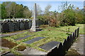
Mynwent Capel Pen-y-maes Burial Ground
The burial ground of Image] is preserved as a garden of rest.
Image: © Alan Fryer
Taken: 2 May 2010
0.16 miles