IMAGES TAKEN NEAR TO
GARNDOLBENMAEN, LL51 9EZ
Introduction
This page details the photographs taken nearby to LL51 9EZ by members of the Geograph project.
The Geograph project started in 2005 with the aim of publishing, organising and preserving representative images for every square kilometre of Great Britain, Ireland and the Isle of Man.

There are currently over 7.5m images from over14,400 individuals and you can help contribute to the project by visiting https://www.geograph.org.uk
Image Map (Loading...)


Getting Data...Please wait
Leaflet Map data © OpenStreetMap
Images are licensed for reuse under creativecommons.org/licenses/by-sa/2.0
Notes
- Clicking on the map will re-center to the selected point.
- The higher the marker number, the further away the image location is from the centre of the postcode.
Image Listing (23 Images Found)
Images are licensed for reuse under creativecommons.org/licenses/by-sa/2.0
Image
Details
Distance
3
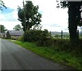
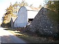
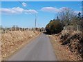
Road near Plas Llecheiddior
National Cycle Network route 8 runs along the road.
Image: © DS Pugh
Taken: 1 Aug 2023
0.09 miles
4
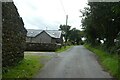
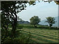
Lane near Plas Llecheiddior
National Cycle Network route 8 runs along the road.
Image: © DS Pugh
Taken: 1 Aug 2023
0.09 miles
5
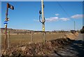
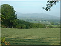
Cycle Route 8 northwards towards Clynnog
Image: © Eric Jones
Taken: 14 Jan 2008
0.09 miles
8
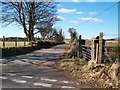
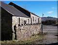
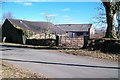
Road junction north of Plas Llecheiddior
This minor road runs cross country towards Llangybi.
Image: © Eric Jones
Taken: 14 Jan 2008
0.14 miles