
IMAGES TAKEN NEAR TO
Glanmorfa Terrace, PORTHMADOG, LL49 9RW
Introduction
This page details the photographs taken nearby to Glanmorfa Terrace, LL49 9RW by members of the Geograph project.
The Geograph project started in 2005 with the aim of publishing, organising and preserving representative images for every square kilometre of Great Britain, Ireland and the Isle of Man.

There are currently over 7.5m images from over14,400 individuals and you can help contribute to the project by visiting https://www.geograph.org.uk
Image Map
Images are licensed for reuse under creativecommons.org/licenses/by-sa/2.0
Notes
- Clicking on the map will re-center to the selected point.
- The higher the marker number, the further away the image location is from the centre of the postcode.
Image Listing (25 Images Found)
Images are licensed for reuse under creativecommons.org/licenses/by-sa/2.0
Image
Details
Distance
4
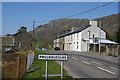
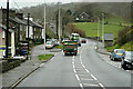
The A487 through Pwllgoleulas
This is a tiny hamlet consisting of two terraced rows opposite each other. There was unfortunately a police incident here which briefly hit the national news, just a few days after this was taken.
Image: © Bill Boaden
Taken: 25 Mar 2012
0.04 miles
5
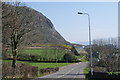
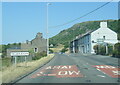
The A487 below Craig y Castell
The road is descending to the Glaslyn plain.
Image: © Bill Boaden
Taken: 25 Mar 2012
0.10 miles
7
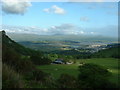
Cwm Bach Farm, Tremadog
The farm has a wonderful outlook - over the Glaslyn Estuary and the town of Porthmadog, across to the Rhinog mountains.
Image: © David Medcalf
Taken: 14 Jun 2005
0.14 miles
8
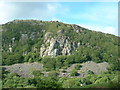
Craig y Castell, Tremadog
The beautiful clean buttress of Creagh Dhu Wall dominates the centre of the photo
Image: © David Medcalf
Taken: 14 Jun 2005
0.14 miles
9
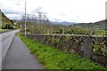
Milestone On A487
Old slate milestone in the wall on the A487 at Penmorfa, Gwynedd for closeup view see http://www.geograph.org.uk/photo/5372751
Image: © Keith Evans
Taken: 29 Apr 2017
0.15 miles
10

Old Milestone by the former A487, Penmorfa, Dolbenmaen parish
Carnarvon champhered slate by the UC was (A487), in parish of Dolbenmaen (Gwynedd District), by stone wall on verge. Erected in the 19th century.
Inscription reads:-
...........MILES
CARNARVON 18
PENYGROES 9⅝
LLANLLYFNI 11
TREMADOC 1
PORTHMADOC 2
Carved benchmark recorded on lower face.
Not yet Surveyed
Milestone Society National ID: CAE_CVTM18
Image: © Chris Leather
Taken: 22 Jun 2025
0.16 miles