
IMAGES TAKEN NEAR TO
Garth Road, PORTHMADOG, LL49 9BN
Introduction
This page details the photographs taken nearby to Garth Road, LL49 9BN by members of the Geograph project.
The Geograph project started in 2005 with the aim of publishing, organising and preserving representative images for every square kilometre of Great Britain, Ireland and the Isle of Man.

There are currently over 7.5m images from over14,400 individuals and you can help contribute to the project by visiting https://www.geograph.org.uk
Image Map
Images are licensed for reuse under creativecommons.org/licenses/by-sa/2.0
Notes
- Clicking on the map will re-center to the selected point.
- The higher the marker number, the further away the image location is from the centre of the postcode.
Image Listing (583 Images Found)
Images are licensed for reuse under creativecommons.org/licenses/by-sa/2.0
Image
Details
Distance
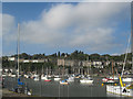
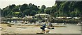
3
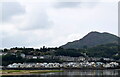
Porthmadog as seen from the Cob
Note modern waterside apartments in front and farther back Victorian villas on Garth Road. Moel y Gest (elev. 262 m) looms up behind the town.
Image: © Bill Harrison
Taken: 22 Jul 2022
0.05 miles
4
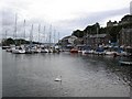
Porthmadog harbour
Just on the seaward side of the cob stands Porthmadog harbour.
Image: © DS Pugh
Taken: 30 Aug 2006
0.05 miles
5
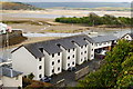
Flats by Porthmadog Harbour, Gwynedd
Located beside the harbour entrance, and served by a road, along which it is possible to walk, to Borth-y-Gest; a small bay, overlooked by some guest houses. Near the centre of picture, and covered with small trees, is Cei Ballast (Ballast Bank); formed, in the middle/late 19th century, by in-coming sailing ships dumping ballast, before taking on full loads of slate.
Image: © Peter Trimming
Taken: 29 Apr 2010
0.06 miles
6
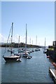
Porthmadog - Harbour
In the second half of the 19th century Porthmadog was a flourishing port, its population expanding from 885 in 1821 to over 3,000 by 1861. The rapidly expanding cities of England needed high quality roofing slate, which was transported to the new port by tramway from the quarries in Ffestiniog and Llanfrothen.
Image: © Ken Bagnall
Taken: 12 Apr 2009
0.07 miles
7
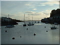
Porthmadog Harbour
Looking south, with the southern tip of Cei Ballast [Ballast Island] visible on the left, behind the harbourside apartments. The lines of mooring buoys stretching into the distance show the popularity of the harbour in the summer months.
Image: © David Medcalf
Taken: 27 Nov 2005
0.07 miles
8
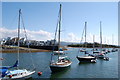
Porthmadog - Harbour
In the second half of the 19th century Porthmadog was a flourishing port, its population expanding from 885 in 1821 to over 3,000 by 1861. The rapidly expanding cities of England needed high quality roofing slate, which was transported to the new port by tramway from the quarries in Ffestiniog and Llanfrothen.
Image: © Ken Bagnall
Taken: 12 Apr 2009
0.07 miles
9
![Porthmadog Wharf and Moel-y-gest [hill]](https://s0.geograph.org.uk/geophotos/07/39/70/7397064_1b408450_120x120.jpg)
Porthmadog Wharf and Moel-y-gest [hill]
Viewed from The Cob.
Image: © John Lucas
Taken: 31 Jan 2023
0.07 miles
10
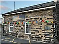
Good Mood Restaurant
Good Mood Restaurant, Madoc Yacht Club.
Image: © Arthur C Harris
Taken: 1 Sep 2022
0.07 miles