
IMAGES TAKEN NEAR TO
Llanfrothen, PENRHYNDEUDRAETH, LL48 6DQ
Introduction
This page details the photographs taken nearby to LL48 6DQ by members of the Geograph project.
The Geograph project started in 2005 with the aim of publishing, organising and preserving representative images for every square kilometre of Great Britain, Ireland and the Isle of Man.

There are currently over 7.5m images from over14,400 individuals and you can help contribute to the project by visiting https://www.geograph.org.uk
Image Map
Images are licensed for reuse under creativecommons.org/licenses/by-sa/2.0
Notes
- Clicking on the map will re-center to the selected point.
- The higher the marker number, the further away the image location is from the centre of the postcode.
Image Listing (25 Images Found)
Images are licensed for reuse under creativecommons.org/licenses/by-sa/2.0
Image
Details
Distance
1
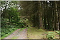
Cae Uchaf
The habitation lies down the slope, out of picture to the right. Many of the conifer plantations, at this location, have been felled in recent years.
Image: © Peter Trimming
Taken: 24 Jul 2019
0.04 miles
2

An old quarry
With the entrance blocked by a recently fallen tree.
Image: © David Medcalf
Taken: 23 Feb 2014
0.05 miles
3

Quarry tips below Pen yr Allt
There are several of these sites where the forest has grown up around them.
Image: © Bill Boaden
Taken: 29 Mar 2012
0.07 miles
4

Forest track and a new drain
A new, gravel-covered, drain crosses the track. This track was completely blocked with fallen trees after the 2014 storm.
Image: © David Medcalf
Taken: 6 Mar 2021
0.07 miles
5

Blocked track
After the storm in early February 2014.
Image: © David Medcalf
Taken: 23 Feb 2014
0.07 miles
6

A matrix of fallen trees
This area of forestry plantation, on the western slopes of the Moelwynion, seems susceptible to storm damage.
Image: © David Medcalf
Taken: 6 Mar 2021
0.10 miles
7

The old quarry
The fallen tree has been cleared since: https://www.geograph.org.uk/photo/3872893
Image: © David Medcalf
Taken: 6 Mar 2021
0.10 miles
8

Collapsing trees near Cae Uchaf
They look as if they are falling in slow motion - and they probably are!
Image: © David Medcalf
Taken: 6 Mar 2021
0.10 miles
9
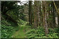
Cae Uchaf
The track, prior to the turn for the habitation which lies, down the slope, to the right. Whilst this area appears well wooded, many conifer plantations have been felled in recent years.
Image: © Peter Trimming
Taken: 24 Jul 2019
0.12 miles
10

Old Wall and Woodland near Croesor
Old Wall and Woodland to the south of Croesor.
Image: © Jeff Buck
Taken: 23 Jan 2009
0.13 miles