
IMAGES TAKEN NEAR TO
TALSARNAU, LL47 6UE
Introduction
This page details the photographs taken nearby to LL47 6UE by members of the Geograph project.
The Geograph project started in 2005 with the aim of publishing, organising and preserving representative images for every square kilometre of Great Britain, Ireland and the Isle of Man.

There are currently over 7.5m images from over14,400 individuals and you can help contribute to the project by visiting https://www.geograph.org.uk
Image Map
Images are licensed for reuse under creativecommons.org/licenses/by-sa/2.0
Notes
- Clicking on the map will re-center to the selected point.
- The higher the marker number, the further away the image location is from the centre of the postcode.
Image Listing (59 Images Found)
Images are licensed for reuse under creativecommons.org/licenses/by-sa/2.0
Image
Details
Distance
1
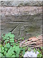
Ordnance Survey Cut Mark
This OS cut mark can be found on the NW face of Christ Church. It marks a point 4.990m above mean sea level.
Image: © Adrian Dust
Taken: 29 Mar 2016
0.01 miles
2
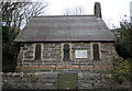
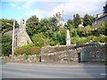
Christ Church Talsarnau
Christ Church,Talsarnau,recently decreed "redundant" by higher authority,
a decision not appreciated by members of the congregation.
Image: © Arthur C Harris
Taken: 30 Mar 2014
0.02 miles
4
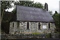
Christ Church Talsarnau
** Christ Church is a small church situated adjacent to the main road (A496) at the northern end of Talsarnau. It was built in 1871 for services in English, under the patronage of Lord Harlech. The building was designed by W.H. Spaull. It is constructed with coursed large slabs of local stone, finer, paler window dressings and has a steep patterned-slate roof. It consists of a single small chamber with a canted apse and a west bellcote. The entrance is in the west end wall though early maps suggest there was once a porch here the footings of which still survive. Windows contain contemporary stained glass (by Edmundson and sons) in the sanctuary apse, nave and west gable end.
The church was declared redundant in 2014.
** Courtesy Coflein
Image: © Arthur C Harris
Taken: 8 Aug 2021
0.02 miles
9

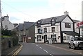
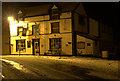
The Ship Aground, Talsarnau
Located on the A496 about 3 miles north of Harlech Castle, Ship Aground has a distinctive façade of black and brilliant white that makes it easy to find.
Image: © Maigheach-gheal
Taken: 5 Sep 2007
0.03 miles
10
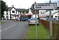
Talsarnau, Gwynedd
Entering Talsarnau on the A496 from the north.
Image: © Arthur C Harris
Taken: 5 Jul 2015
0.03 miles