IMAGES TAKEN NEAR TO
HARLECH, LL46 2TF
Introduction
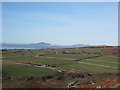
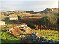
This page details the photographs taken nearby to LL46 2TF by members of the Geograph project.
The Geograph project started in 2005 with the aim of publishing, organising and preserving representative images for every square kilometre of Great Britain, Ireland and the Isle of Man.

There are currently over 7.5m images from over14,400 individuals and you can help contribute to the project by visiting https://www.geograph.org.uk
Image Map (Loading...)


Getting Data...Please wait
Leaflet Map data © OpenStreetMap
Images are licensed for reuse under creativecommons.org/licenses/by-sa/2.0
Notes
- Clicking on the map will re-center to the selected point.
- The higher the marker number, the further away the image location is from the centre of the postcode.
Image Listing (4 Images Found)
Images are licensed for reuse under creativecommons.org/licenses/by-sa/2.0
Image
Details
Distance
3
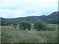
Lake site
This is just bog, and is shown as such on the map. However, looking at the surroundings, it's very clearly the site of an ancient lake.
Image: © David Medcalf
Taken: 28 Jun 2006
0.20 miles