
IMAGES TAKEN NEAR TO
Fron Hill Estate, HARLECH, LL46 2TD
Introduction
This page details the photographs taken nearby to Fron Hill Estate, LL46 2TD by members of the Geograph project.
The Geograph project started in 2005 with the aim of publishing, organising and preserving representative images for every square kilometre of Great Britain, Ireland and the Isle of Man.

There are currently over 7.5m images from over14,400 individuals and you can help contribute to the project by visiting https://www.geograph.org.uk
Image Map
Images are licensed for reuse under creativecommons.org/licenses/by-sa/2.0
Notes
- Clicking on the map will re-center to the selected point.
- The higher the marker number, the further away the image location is from the centre of the postcode.
Image Listing (28 Images Found)
Images are licensed for reuse under creativecommons.org/licenses/by-sa/2.0
Image
Details
Distance
1
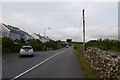
Housing in Llanfair
Some of the more modern housing in Llanfair.
Image: © DS Pugh
Taken: 18 Jul 2015
0.02 miles
2
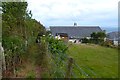
Footpath to Llanfair
Footpath emerging between houses into Llanfair.
Image: © DS Pugh
Taken: 18 Jul 2015
0.03 miles
3
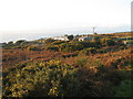
Houses near Llanfair
The gorse is in bloom, even at the end of November.
Image: © David Medcalf
Taken: 29 Nov 2007
0.04 miles
4
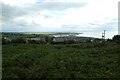
Houses on Fronlief Hir
Looking towards the road from a footpath over fields above Llanfair.
Image: © DS Pugh
Taken: 2 Aug 2023
0.04 miles
5
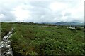
Wall from a stile
Looking along a wall above Llanfair from where a footpath crosses the wall using a stile.
Image: © DS Pugh
Taken: 2 Aug 2023
0.06 miles
6
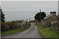
Minor road climbing up from Llanfair
The road is one of several serving the uplands between the coastal strip and the Rhinog backbone. Here it passes a small hamlet which consists of the odd cottage together with a number of modern bungalows. Llŷn can be seen in the distance across Cardigan Bay.
Image: © Nigel Brown
Taken: 23 Oct 2009
0.07 miles
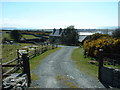
8
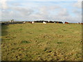
Farmland near Llanfair
Looking west. The 1:25,000 map shows a reservoir near the old barn.
Image: © David Medcalf
Taken: 29 Nov 2007
0.08 miles
9
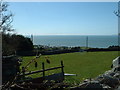
Farmland near Llanfair
Looking WSW. The end of the Llŷn Peninsula is just visible, centre right.
Image: © David Medcalf
Taken: 4 Apr 2006
0.10 miles
10
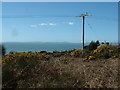
Gorse bushes near Llanfair
Looking west towards the Llŷn Peninsula.
Image: © David Medcalf
Taken: 4 Apr 2006
0.11 miles