
IMAGES TAKEN NEAR TO
Marine Place, BARMOUTH, LL42 1HF
Introduction
This page details the photographs taken nearby to Marine Place, LL42 1HF by members of the Geograph project.
The Geograph project started in 2005 with the aim of publishing, organising and preserving representative images for every square kilometre of Great Britain, Ireland and the Isle of Man.

There are currently over 7.5m images from over14,400 individuals and you can help contribute to the project by visiting https://www.geograph.org.uk
Image Map
Images are licensed for reuse under creativecommons.org/licenses/by-sa/2.0
Notes
- Clicking on the map will re-center to the selected point.
- The higher the marker number, the further away the image location is from the centre of the postcode.
Image Listing (112 Images Found)
Images are licensed for reuse under creativecommons.org/licenses/by-sa/2.0
Image
Details
Distance
1
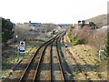
The railway north from Barmouth
The station is just to the south, and double tracked; here the track becomes single as it heads to Harlech. Viewed from the footbridge linking Park Road and Marine Gardens.
Image: © M J Richardson
Taken: 4 Mar 2011
0.04 miles
2
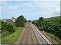
Lines out of Barmouth
Looking north from the Epworth Footbridge.
Image: © Gerald England
Taken: 13 Jul 2023
0.04 miles
3
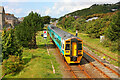
Railway at Barmouth
View from the footbridge in Barmouth.
Image: © Wayland Smith
Taken: 27 Aug 2010
0.05 miles
4
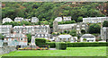
War memorial at Barmouth
The memorial is beyond the flower bed at the left side of the image. Large houses and / or guest houses occupy the rising slope beyond.
Image: © Trevor Littlewood
Taken: 6 Sep 2018
0.07 miles
5
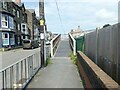
Epworth Footbridge
Western access from Marine Road to Bridge DJP 100 62.5 over the railway line from Dolgellau to Pwllheli.
Image: © Gerald England
Taken: 13 Jul 2023
0.07 miles
6
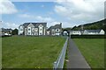
Path beside the bowling club
The path runs between Epworth Road and Northfield Road.
Image: © DS Pugh
Taken: 4 Aug 2023
0.07 miles
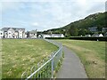
8
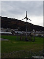
Another great idea...
On council land, a derelict wind turbine flaps in the wind - but the blades weren't turning and seem unlikely ever to do so again. A great idea to install an electrical machine where it continually receives the full force of stormy weather and a salt laden atmosphere. Still, I expect that it 'ticked a few boxes' at the time. (When I was submitting this image my mouse hovered over the 'Energy infrastructure' context box but I chose not to select it - that would have been a travesty!)
Image: © John Lucas
Taken: 26 Oct 2015
0.08 miles
9
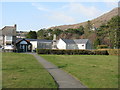
Barmouth Bowling Club
From Bryn Mynach Road.
Image: © M J Richardson
Taken: 4 Mar 2011
0.08 miles
10
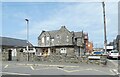
Ysgol y Traeth
Primary School on Princes Avenue.
Image: © Gerald England
Taken: 13 Jul 2023
0.10 miles