
IMAGES TAKEN NEAR TO
Caerdeon, BARMOUTH, LL42 1DZ
Introduction
This page details the photographs taken nearby to Caerdeon, LL42 1DZ by members of the Geograph project.
The Geograph project started in 2005 with the aim of publishing, organising and preserving representative images for every square kilometre of Great Britain, Ireland and the Isle of Man.

There are currently over 7.5m images from over14,400 individuals and you can help contribute to the project by visiting https://www.geograph.org.uk
Image Map
Images are licensed for reuse under creativecommons.org/licenses/by-sa/2.0
Notes
- Clicking on the map will re-center to the selected point.
- The higher the marker number, the further away the image location is from the centre of the postcode.
Image Listing (6 Images Found)
Images are licensed for reuse under creativecommons.org/licenses/by-sa/2.0
Image
Details
Distance
1
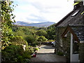
Cae Gwian.
Looking across the Cae Gwian's porch towards cadair idris.
Image: © Hefin Richards
Taken: 24 Sep 2006
0.11 miles
2
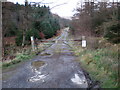
Private road to Cae Gwian Estate.
The use of a 4x4 is more or less essential in this area in winter time.
Image: © Hefin Richards
Taken: 21 Jan 2007
0.14 miles
3
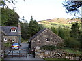
Cae Gwian.
Looking towards "Y Figra".
Image: © Hefin Richards
Taken: 24 Sep 2006
0.15 miles
4
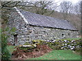
Old barn at Cae Gwian.
This old barn is in remarkably good condition and without signs of any modern repairs. An interesting picture has been carved into the large stone to the right of the door. Image
Image: © Hefin Richards
Taken: 21 Jan 2007
0.16 miles
5
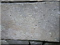
Neolithic mountain bike drawing. ;-)
This carving appears on a stone in the wall of the old barn at Cae Gwian.
http://www.geograph.org.uk/photo/317897
Image: © Hefin Richards
Taken: 21 Jan 2007
0.17 miles
6
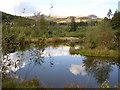
Forestry Pond.
Near Bwlch yr Ysgol, looking towards Diffwys.
Image: © Hefin Richards
Taken: 24 Sep 2006
0.25 miles