IMAGES TAKEN NEAR TO
BARMOUTH, LL42 1DN

Introduction

This page details the photographs taken nearby to LL42 1DN by members of the Geograph project.

The Geograph project started in 2005 with the aim of publishing, organising and preserving representative images for every square kilometre of Great Britain, Ireland and the Isle of Man.

There are currently over 7.5m images from over14,400 individuals and you can help contribute to the project by visiting https://www.geograph.org.uk

Image Map


Images are licensed for reuse under creativecommons.org/licenses/by-sa/2.0
Notes
  • Clicking on the map will re-center to the selected point.
  • The higher the marker number, the further away the image location is from the centre of the postcode.

Image Listing (601 Images Found)

Images are licensed for reuse under creativecommons.org/licenses/by-sa/2.0
  • ...
Image
Details
Distance
1
Barmouth
The original site of the old town is in the area where the houses cling to the steep sides of "The Rock." The lower and larger area of Barmouth developed as a tourist resort following the arrival of the railway in 1867.
Image: © Trevor Harris Taken: 30 Jul 2009
0.02 miles
2
Dinas Oleu, Barmouth
Image: © Bryn Holmes Taken: 3 Jul 2021
0.02 miles
3
View over Barmouth
A view from a track on the hillside overlooking Barmouth, on the coast of Wales.
Image: © Malc McDonald Taken: 9 Aug 2023
0.03 miles
4
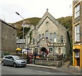
Ebenezer Chapel
The Grade II listed Ebenezer Methodist Chapel was built in 1806 and rebuilt in 1856 in the Gothic style of the gable-entry type The chapel interior was renewed, an organ installed and porches added in 1880, and land bought for a rear Sunday School. I've not been able to determine when it closed as a place of worship. Part of the chapel has been converted to a holiday rental apartment http://bellsandlabs.blogspot.com/p/ebenezer-chapel-barmouth-holiday-rental.html while the rest is now a coffee shop, an arts & crafts centre and an emporium.
Image: © Gerald England Taken: 15 Sep 2018
0.03 miles
5
Lion Hotel
Seemingly undergoing renovation
Image: © Arthur C Harris Taken: 15 Jun 2021
0.03 miles
6
Path onto Dinas Oleu, Barmouth
Stones form steps on a path on the steep hillside above the town of Barmouth, on the coast of Wales. The path leads into Dinas Oleu, a piece of land which belongs to the National Trust.
Image: © Malc McDonald Taken: 9 Aug 2023
0.03 miles
7
Walter Lloyd Jones Saleroom, Barmouth
This business has been established for over one hundred and ten years and has been based in these premises since the 1920s.
Image: © Dave Croker Taken: 25 Feb 2023
0.03 miles
8
Dry stone walls
Dry-stone walls on Dinas Oleu, the first land donated to the National Trust.
Image: © Eirian Evans Taken: 12 Jun 2006
0.03 miles
9
Path overlooking Barmouth
A grassy path on the steep hill overlooking the town of Barmouth, on the Welsh coast. This view looks south, across the estuary of the Afon Mawddach.
Image: © Malc McDonald Taken: 9 Aug 2023
0.03 miles
10
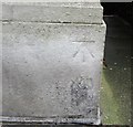
Ordnance Survey Cut Mark
This OS cut mark can be found on the old Stores. It marks a point 9.127m above mean sea level.
Image: © Adrian Dust Taken: 10 May 2016
0.03 miles
  • ...