
IMAGES TAKEN NEAR TO
Trawsfynydd, BLAENAU FFESTINIOG, LL41 4UY
Introduction
This page details the photographs taken nearby to LL41 4UY by members of the Geograph project.
The Geograph project started in 2005 with the aim of publishing, organising and preserving representative images for every square kilometre of Great Britain, Ireland and the Isle of Man.

There are currently over 7.5m images from over14,400 individuals and you can help contribute to the project by visiting https://www.geograph.org.uk
Image Map
Images are licensed for reuse under creativecommons.org/licenses/by-sa/2.0
Notes
- Clicking on the map will re-center to the selected point.
- The higher the marker number, the further away the image location is from the centre of the postcode.
Image Listing (25 Images Found)
Images are licensed for reuse under creativecommons.org/licenses/by-sa/2.0
Image
Details
Distance
1
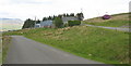
Ffermdy Penystryd and two merging country roads
Image: © Eric Jones
Taken: 5 Jun 2007
0.01 miles
2
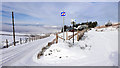
Road junction at Penystryd
To the left for Bronaber on the main A470 road and the Trawsfynydd Holiday Village. Directly ahead, a minor road to Trawsfynydd which forms part of cycle route 82.
Image: © John Lucas
Taken: 23 Jan 2019
0.02 miles
3
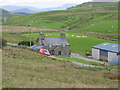
Ffermdy Penystryd
With the postman on his rounds.
Image: © Dewi
Taken: 26 May 2007
0.05 miles
4
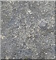
Ordnance Survey Rivet
This OS rivet can be found on the culvert NE side of the road. It marks a point 325.828m above mean sea level.
Image: © Adrian Dust
Taken: 14 Oct 2022
0.06 miles
5
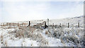
Footpath from Penrystryd
Just ahead, the path joins the route of Sarn Helen, a long distance Roman road which ran from north to south Wales.
Image: © John Lucas
Taken: 23 Jan 2019
0.06 miles
6
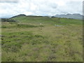
Looking down on the crossroads at Penystryd
Image: © David Medcalf
Taken: 2 Jul 2016
0.07 miles
7
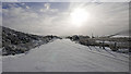
Wide minor road at Penystryd
At the junction of four roads. Directly ahead will lead by a mountain road to Llanuwchllyn. A 'no through road' to Gwynfynydd bears to the right.
Image: © John Lucas
Taken: 23 Jan 2019
0.07 miles
8
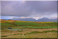
Penystryd
Heulwen cynnar a chymylau ar y Rhinogydd / Early sunshine on the Rhinogs.
Image: © Ian Medcalf
Taken: 7 Aug 2014
0.08 miles
9
Minor road at Penystryd
This was an area of significance in Roman Britain. The Roman road Sarn Helen passed nearby here and there were Roman kilns in the area.
Image: © John Lucas
Taken: 23 Jan 2019
0.09 miles
10
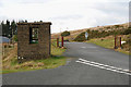
Old MOD police shelter
It now appears to be used to protect waste-bins. See Image for another shot. Thanks to David Medcalf for drawing my attention to the origins of the building.
Image: © Nigel Brown
Taken: 10 Dec 2009
0.09 miles