IMAGES TAKEN NEAR TO
Gellilydan, BLAENAU FFESTINIOG, LL41 4ER
Introduction
This page details the photographs taken nearby to LL41 4ER by members of the Geograph project.
The Geograph project started in 2005 with the aim of publishing, organising and preserving representative images for every square kilometre of Great Britain, Ireland and the Isle of Man.

There are currently over 7.5m images from over14,400 individuals and you can help contribute to the project by visiting https://www.geograph.org.uk
Image Map
Images are licensed for reuse under creativecommons.org/licenses/by-sa/2.0
Notes
- Clicking on the map will re-center to the selected point.
- The higher the marker number, the further away the image location is from the centre of the postcode.
Image Listing (15 Images Found)
Images are licensed for reuse under creativecommons.org/licenses/by-sa/2.0
Image
Details
Distance
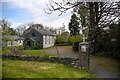
1
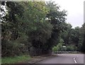
Sharp bend on A487
At back of houses in Gellilydan
Image: © John Firth
Taken: 6 Oct 2013
0.03 miles
3
Footpath crossing A487
Under power lines near Gellilydan
Image: © John Firth
Taken: 6 Oct 2013
0.08 miles
4
Maentwrog : Holy Cross Church
Probably late C18 building, formerly a tannery and converted to use as a Roman Catholic church in mid C20. The area had experienced an influx of Irish workers, brought from County Cork to build the dams for the original Maentwrog hydo-electric scheme. Some were said to have stayed on in the area, and the Church is said to reflect this history.
Image: © Lewis Clarke
Taken: 22 Apr 2024
0.08 miles
5
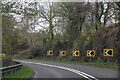
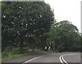
Maentwrog : A487
Looking along the A487.
Image: © Lewis Clarke
Taken: 22 Apr 2024
0.16 miles
6
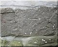
Ordnance Survey Cut Mark
This OS cut mark can be found on No1 Gellilydan Terrace. It marks a point 152.684m above mean sea level.
Image: © Adrian Dust
Taken: 11 May 2016
0.17 miles
7
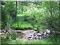
Stream
Footpath crossing a stream near to Gellilydan, Gwynedd.
Image: © Keith Evans
Taken: 21 Jun 2018
0.18 miles
8
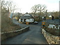
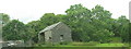
Gellilydan village
looking towards the village stores from the bridge over the Afon Tafarn-Helyg [which appears to change its name to Ceunant Llechrwd 1 km downstream]
Image: © David Medcalf
Taken: 16 Jan 2006
0.19 miles
9
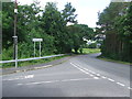
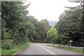
Junction Of The A487
Junction of the A487 at Gellilydan, Gwynedd.
Image: © Keith Evans
Taken: 21 Jun 2018
0.20 miles