
IMAGES TAKEN NEAR TO
Gellilydan, BLAENAU FFESTINIOG, LL41 4DY
Introduction
This page details the photographs taken nearby to LL41 4DY by members of the Geograph project.
The Geograph project started in 2005 with the aim of publishing, organising and preserving representative images for every square kilometre of Great Britain, Ireland and the Isle of Man.

There are currently over 7.5m images from over14,400 individuals and you can help contribute to the project by visiting https://www.geograph.org.uk
Image Map
Images are licensed for reuse under creativecommons.org/licenses/by-sa/2.0
Notes
- Clicking on the map will re-center to the selected point.
- The higher the marker number, the further away the image location is from the centre of the postcode.
Image Listing (19 Images Found)
Images are licensed for reuse under creativecommons.org/licenses/by-sa/2.0
Image
Details
Distance
1
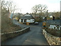
Gellilydan village
looking towards the village stores from the bridge over the Afon Tafarn-Helyg [which appears to change its name to Ceunant Llechrwd 1 km downstream]
Image: © David Medcalf
Taken: 16 Jan 2006
0.08 miles
2
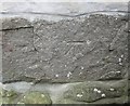
Ordnance Survey Cut Mark
This OS cut mark can be found on No1 Gellilydan Terrace. It marks a point 152.684m above mean sea level.
Image: © Adrian Dust
Taken: 11 May 2016
0.12 miles
3
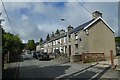
Houses in Gellilydan
Looking along a terrace in the village of Gellilydan.
Image: © DS Pugh
Taken: 3 Aug 2020
0.12 miles
4
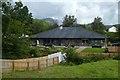
Public house in Gellilydan
Looking towards the Bryn Arms.
Image: © DS Pugh
Taken: 3 Aug 2020
0.13 miles
5
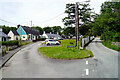
Coed y Llwyn
Houses on the edge of Gellilydan. The minor road on the right runs over the hills and joins the A496 road near Maentwrog power station Image
Image: © John Lucas
Taken: 16 Jun 2022
0.14 miles
6
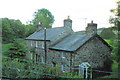
The former Tafarn yr Helyg Inn
Tafarn yr Helyg translates as "willow tavern". Now a private house. The former drove road to Trawsfynydd runs in front of it. That's now a public footpath.
Image: © Eric Jones
Taken: 18 Jul 2007
0.14 miles
8
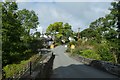
Road to Gellilydan
Looking towards Gellilydan just after leaving the A487.
Image: © DS Pugh
Taken: 3 Aug 2020
0.15 miles
9
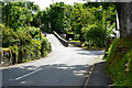
A road out from Gellilydan
Leads to the A487 road.
Image: © John Lucas
Taken: 16 Jun 2022
0.15 miles
10
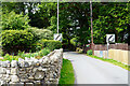
Leaving Gellilyden
The back road over the hills to Maentwrog.
Image: © John Lucas
Taken: 16 Jun 2022
0.15 miles