
IMAGES TAKEN NEAR TO
BLAENAU FFESTINIOG, LL41 4BN
Introduction
This page details the photographs taken nearby to LL41 4BN by members of the Geograph project.
The Geograph project started in 2005 with the aim of publishing, organising and preserving representative images for every square kilometre of Great Britain, Ireland and the Isle of Man.

There are currently over 7.5m images from over14,400 individuals and you can help contribute to the project by visiting https://www.geograph.org.uk
Image Map
Images are licensed for reuse under creativecommons.org/licenses/by-sa/2.0
Notes
- Clicking on the map will re-center to the selected point.
- The higher the marker number, the further away the image location is from the centre of the postcode.
Image Listing (22 Images Found)
Images are licensed for reuse under creativecommons.org/licenses/by-sa/2.0
Image
Details
Distance

2
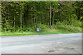
Ffin Parc Cenedlaethol Eryri / Snowdonia National Park Boundary
Ffin Parc Cenedlaethol Eryri ger Coed Pengwern/ Snowdonia National Park Boundary near Coed Pengwern.
Image: © Ian Medcalf
Taken: 14 May 2014
0.07 miles
3

Ffestiniog : Road
A road off the A496.
Image: © Lewis Clarke
Taken: 21 Apr 2024
0.08 miles
4

Approaching the A496
Looking along the end of a minor road between Blaenau Road and the A496.
Image: © DS Pugh
Taken: 6 Aug 2020
0.08 miles

6

Ffestiniog : A496
Looking along the A496.
Image: © Lewis Clarke
Taken: 21 Apr 2024
0.10 miles


9

Waterfall on the Afon Goedol
One of several spectacular falls along this stretch of the river. This one has its own viewing area.
Image: © Paul Glover
Taken: 28 May 2011
0.15 miles
10

Waymarked path, west bank, Afon Goedol
There is a network of paths around Blaenau Ffestiniog, linking homes, schools, quarries and chapels. This one is part of both the Ardal Moel Ystradau Area and the Ardal Coed Pengwern Area circular walks, nos. 3 and 4 in the town leaflet.
Image: © Christine Johnstone
Taken: 30 Apr 2017
0.15 miles