
IMAGES TAKEN NEAR TO
BLAENAU FFESTINIOG, LL41 3YB
Introduction
This page details the photographs taken nearby to LL41 3YB by members of the Geograph project.
The Geograph project started in 2005 with the aim of publishing, organising and preserving representative images for every square kilometre of Great Britain, Ireland and the Isle of Man.

There are currently over 7.5m images from over14,400 individuals and you can help contribute to the project by visiting https://www.geograph.org.uk
Image Map
Images are licensed for reuse under creativecommons.org/licenses/by-sa/2.0
Notes
- Clicking on the map will re-center to the selected point.
- The higher the marker number, the further away the image location is from the centre of the postcode.
Image Listing (180 Images Found)
Images are licensed for reuse under creativecommons.org/licenses/by-sa/2.0
Image
Details
Distance
1
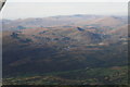
Snowdonia NW of Blaenau Ffestiniog: aerial 2015
Image: © Chris
Taken: 28 Sep 2015
0.03 miles
2
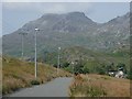
Footpath to Oakley Square and Tanygrisiau
The most direct route for pedestrians has fine views ahead to the Moelwyn range - Moelwyn Bach being the main summit in this picture.
Image: © Andrew Hill
Taken: 2 Jul 2014
0.06 miles
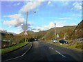

5

Capel Calfaria datestone, Blaenau Ffestiniog
Calfaria
Capel y Bedyddwyr
A.D. 1881.
See also: Image
Image: © Meirion
Taken: 20 Jun 2025
0.07 miles
6
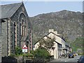
Towyn Road, Blaenau Ffestiniog
View past one of the many chapels in the town with the steep slopes of Craig Nyth-y-gigfran as the backdrop.
Image: © Andrew Hill
Taken: 2 Jul 2014
0.08 miles
7
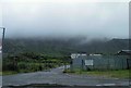
Low cloud over Blaenau Ffestiniog
On the left of the track is the rugby field.
Image: © Steve Fareham
Taken: 17 Jul 2012
0.09 miles
8
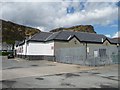
Eurospar, Blaenau Ffestiniog
A supermarket on Wynne Road, south of The Square.
Image: © Christine Johnstone
Taken: 29 May 2015
0.13 miles
9
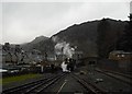
Approach to Blaenau Ffestiniog station
On the right the standard gauge tracks of the Conwy Valley line and on the left the narrow gauge tracks of the Ffestiniog Railway. Both sets of tracks are crossed by a footbridge and in the distance the bridge carrying the A496. To the left 19th century housing. Craig Nyth-y-gigfran dominates the scene.
Image: © Christopher Hall
Taken: 31 Dec 2013
0.13 miles
10

Narrow and standard gauge lines
On the left the Ffestiniog narrow gauge to Porthmadog whilst on the right the standard gauge to Llandudno.
Viewed from the Dorvil road bridge.
For an opposite view see Image]
Image: © Richard Hoare
Taken: 10 Jul 2025
0.13 miles