
IMAGES TAKEN NEAR TO
Bryn Tegai, BLAENAU FFESTINIOG, LL41 3DZ
Introduction
This page details the photographs taken nearby to Bryn Tegai, LL41 3DZ by members of the Geograph project.
The Geograph project started in 2005 with the aim of publishing, organising and preserving representative images for every square kilometre of Great Britain, Ireland and the Isle of Man.

There are currently over 7.5m images from over14,400 individuals and you can help contribute to the project by visiting https://www.geograph.org.uk
Image Map
Images are licensed for reuse under creativecommons.org/licenses/by-sa/2.0
Notes
- Clicking on the map will re-center to the selected point.
- The higher the marker number, the further away the image location is from the centre of the postcode.
Image Listing (124 Images Found)
Images are licensed for reuse under creativecommons.org/licenses/by-sa/2.0
Image
Details
Distance
1
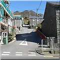
Road to Summerhill, Blaenau Ffestiniog
The unnamed road gives access from High Street to houses in the Summerhill area, built in the 1870s. Streets ahead include Summerhill Terrace, Richmond Terrace and Tanyclogwyn Terrace.
Image: © Jaggery
Taken: 26 Mar 2012
0.00 miles
2
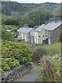
Footpath and hillside terrace of houses, Blaenau Ffestiniog
The town and its remarkable setting are well worth leisurely and detailed exploration.
Image: © Andrew Hill
Taken: 30 Jun 2014
0.01 miles
3
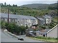
Houses on a hillside, Blaenau Ffestiniog
These modest terraced houses boast spectacular views across the town and Cwm Bowydd to the Moelwyn range.
Image: © Andrew Hill
Taken: 30 Jun 2014
0.02 miles
4
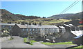
Terraced housing in the Tan-y-Clogwyn area
These houses were built to house 19th century quarrymen and their families.
Image: © Eric Jones
Taken: 5 Oct 2007
0.03 miles
5
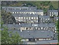
Terraced houses, Blaenau Ffestiniog
A small detail of the amazing view from the top of a little spur overlooking Cwm Bowydd between the hospital and the school in Blaenau Ffestiniog.
Image: © Andrew Hill
Taken: 30 Jun 2014
0.03 miles
6
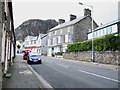
Empty shops at the outer fringe of the commercial core of Blaena'
Image: © Eric Jones
Taken: 28 Sep 2007
0.04 miles
7
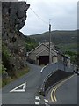
Road junction by a crag, Blaenau Ffestiniog
The houses line the main street through the town.
Image: © Andrew Hill
Taken: 30 Jun 2014
0.05 miles
8
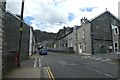
Letterbox in Blaenau Ffestiniog
Looking along the High Street in Blaenau Ffestiniog.
Image: © DS Pugh
Taken: 3 Aug 2020
0.05 miles
9
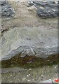
Ordnance Survey Rivet
This OS rivet can be found on No99 High Street. It marks a point 216.148m above mean sea level.
Image: © Adrian Dust
Taken: 11 May 2016
0.06 miles
10
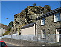
Rocky outcrop, High Street, Blaenau Ffestiniog
The mass of rock is behind a High Street house.
Image: © Jaggery
Taken: 26 Mar 2012
0.06 miles