
IMAGES TAKEN NEAR TO
Pengelli Terrace, BLAENAU FFESTINIOG, LL41 3BZ
Introduction
This page details the photographs taken nearby to Pengelli Terrace, LL41 3BZ by members of the Geograph project.
The Geograph project started in 2005 with the aim of publishing, organising and preserving representative images for every square kilometre of Great Britain, Ireland and the Isle of Man.

There are currently over 7.5m images from over14,400 individuals and you can help contribute to the project by visiting https://www.geograph.org.uk
Image Map
Images are licensed for reuse under creativecommons.org/licenses/by-sa/2.0
Notes
- Clicking on the map will re-center to the selected point.
- The higher the marker number, the further away the image location is from the centre of the postcode.
Image Listing (73 Images Found)
Images are licensed for reuse under creativecommons.org/licenses/by-sa/2.0
Image
Details
Distance
1
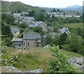
Bethania, Blaenau Ffestiniog
The residential developments line the A470 for a full mile or more away from the town centre of Blaenau Ffestiniog.
Image: © Andrew Hill
Taken: 30 Jun 2014
0.02 miles
2
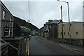
Manod Road
Looking along the A470 in Blaenau Ffestiniog.
Image: © DS Pugh
Taken: 6 Aug 2020
0.05 miles
3
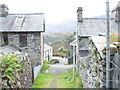
The footpath's exit in Rhes Tabernacl Terrace
The High Street is accessed by steps below the bottom houses.
Image: © Eric Jones
Taken: 28 Sep 2007
0.06 miles
4
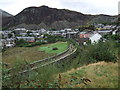
The viaduct and trackbed of former railway line at Blaenau Ffestiniog
Taken from the roadside near Bethania it shows the outline of the track which ran from Blaenau Ffestiniog to Trawsfynydd. In the background is the town of Blaenau Ffestiniog.
Image: © Richard Hoare
Taken: 7 Sep 2009
0.06 miles
5
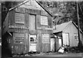
R L Jones Builders and Undertakers, Blaenau Ffestiniog
These historical tin clad buildings are a well known landmark of the A470.
Image: © Eric Jones
Taken: 14 May 1999
0.07 miles
6
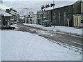
Blaenau Ffestiniog in the snow
Early spring in Snowdonia
Image: © gwyn
Taken: 1 Mar 2006
0.07 miles
7
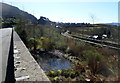
Disused railway viewed from High Street, Blaenau Ffestiniog
The single track line, no longer in use, is between two low walls on the right.
Image: © Jaggery
Taken: 26 Mar 2012
0.07 miles
8
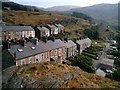
Tan-yr-allt Terrace, Blaenau Ffestiniog.
A view of the old miners and quarrymens cottages called Tan-yr-allt Terrace with Richmond Terrace behind. These cottages are situated near Diphwys Casson Slate Mine.
Image: © Stephen Elwyn RODDICK
Taken: Unknown
0.08 miles
9
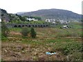
Railway viaduct between Blaenau Ffestiniog and Bethania
Built for the Blaenau Ffestiniog to Bala line, which was truncated to serve only the Trawsfynydd nuclear power station, and is now out of use.
Image: © Christine Johnstone
Taken: 30 Apr 2017
0.08 miles
10
Railway viaduct between Blaenau Ffestiniog and Tan-y-Manod
A wooden version of this viaduct carrying the narrow gauge Festiniog and Blaenau Railway (as spelt then) opened in 1868. That version was deemed too flimsy when the line was rebuilt to standard gauge in 1883, so it was rebuilt as shown here.
The single track line over the viaduct closed to passengers in January 1960 and completely in January 1961. It reopened for freight traffic to Trawsfynydd nuclear power station in 1964, being mothballed in 1998 after the power station closed and all nuclear materials had been removed.
In October 2016 the line remained in place, but heavily overgrown in places.
Image: © David Hull
Taken: 22 Oct 2016
0.09 miles