
IMAGES TAKEN NEAR TO
Pencefn Road, DOLGELLAU, LL40 2YW
Introduction
This page details the photographs taken nearby to Pencefn Road, LL40 2YW by members of the Geograph project.
The Geograph project started in 2005 with the aim of publishing, organising and preserving representative images for every square kilometre of Great Britain, Ireland and the Isle of Man.

There are currently over 7.5m images from over14,400 individuals and you can help contribute to the project by visiting https://www.geograph.org.uk
Image Map
Images are licensed for reuse under creativecommons.org/licenses/by-sa/2.0
Notes
- Clicking on the map will re-center to the selected point.
- The higher the marker number, the further away the image location is from the centre of the postcode.
Image Listing (203 Images Found)
Images are licensed for reuse under creativecommons.org/licenses/by-sa/2.0
Image
Details
Distance
1

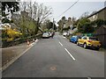
The old A470 heading into Dolgellau
Prior to the bypass being built, all main road traffic from the north and west used this road, of which all traffic heading south passed through the narrow streets of Dolgellau. Traffic jams were normal.
Image: © Nigel Brown
Taken: 20 Jan 2017
0.05 miles
3
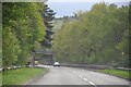
Dolgellau : A470
Looking along the A470.
Image: © Lewis Clarke
Taken: 22 Apr 2024
0.06 miles
4
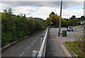
High and low-level roads
The lower road is the A470 by-pass. The higher road is the minor road required for accessing the town.
Image: © Bill Boaden
Taken: 25 Sep 2010
0.07 miles
5
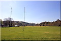
Dolgellau Rugby Ground
Clwb Rygbi Dolgellau (Dolgellau Rugby Club) is situated at Parc Menter Marian Mawr (Marian Mawr Enterprise Park).
Image: © Jeff Buck
Taken: 22 Apr 2015
0.10 miles
6
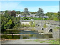
View across the Wnion
Looking along Dolgellau Bridge past the A470 by-pass to the council offices on the north side of the river.
Image: © Jonathan Billinger
Taken: 5 Oct 2009
0.11 miles
7
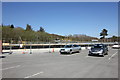
New Flood Wall Construction Work, Dolgellau.
Natural Resources Wales (NRW) is overseeing construction of a new flood wall, approximately a mile long, along the boundary of the Marian Mawr car park, between the Enterprise Park and the school playing field.
Image: © Jeff Buck
Taken: 22 Apr 2015
0.11 miles
8
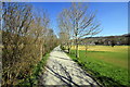
Riverside Walk at Dolgellau
The footpath beside the Afon Wnion and Marian Mawr Recreation Ground.
Image: © Jeff Buck
Taken: 22 Apr 2015
0.11 miles
10
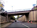
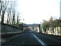
Overbridge over A470 near council offices
Image: © John Firth
Taken: 11 Oct 2015
0.11 miles