IMAGES TAKEN NEAR TO
Tabor Cottages, DOLGELLAU, LL40 2RA
Introduction
This page details the photographs taken nearby to Tabor Cottages, LL40 2RA by members of the Geograph project.
The Geograph project started in 2005 with the aim of publishing, organising and preserving representative images for every square kilometre of Great Britain, Ireland and the Isle of Man.

There are currently over 7.5m images from over14,400 individuals and you can help contribute to the project by visiting https://www.geograph.org.uk
Image Map
Images are licensed for reuse under creativecommons.org/licenses/by-sa/2.0
Notes
- Clicking on the map will re-center to the selected point.
- The higher the marker number, the further away the image location is from the centre of the postcode.
Image Listing (16 Images Found)
Images are licensed for reuse under creativecommons.org/licenses/by-sa/2.0
Image
Details
Distance
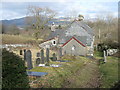
1
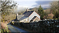
Tyddyn y Garreg Friends' Meeting House, Tabor, Dolgellau
The Quakers established this meeting house and burial ground in 1792. By 1845, Quakers in the area had either emigrated or died and the meeting was closed. The building and burial ground were then purchased by the Welsh Independents and became Tabor Chapel. The burial ground is still used but none of the headstones are of Quaker origin as the Friends did not allow graves to be marked with headstones until 1850.
Image: © John Lucas
Taken: 21 Feb 2019
0.01 miles
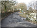
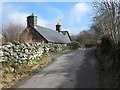
3
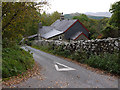
Tabor chapel
At the start of the road to Tabor. This was originally built by the Quakers as a meeting house, later being sold to become a chapel.
Image: © Nigel Brown
Taken: 17 Oct 2010
0.02 miles
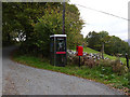
4
Link to the world - it's old technology really
Image: © Row17
Taken: 18 Oct 2011
0.03 miles
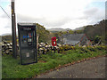
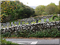
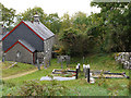
6
Tabor Chapel
Formerly a Friends Meeting House. This area was a centre for Quakerism from George Fox's visit in 1657 to the mid-19th century.
Image: © David Medcalf
Taken: 23 Feb 2009
0.03 miles
9
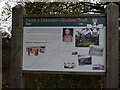
Information board at Tabor
One of several on the Quaker Trail. This one describes the origins of the chapel at Tabor.
Image: © Nigel Brown
Taken: 17 Oct 2010
0.04 miles
10
Tyddyn Mawr
A name plate on Tyddyn Mawr labels it as "Hen Siop" - the Old Shop.
Image: © David Medcalf
Taken: 23 Feb 2009
0.11 miles