
IMAGES TAKEN NEAR TO
Penmaenpool, DOLGELLAU, LL40 1YJ
Introduction
This page details the photographs taken nearby to LL40 1YJ by members of the Geograph project.
The Geograph project started in 2005 with the aim of publishing, organising and preserving representative images for every square kilometre of Great Britain, Ireland and the Isle of Man.

There are currently over 7.5m images from over14,400 individuals and you can help contribute to the project by visiting https://www.geograph.org.uk
Image Map
Images are licensed for reuse under creativecommons.org/licenses/by-sa/2.0
Notes
- Clicking on the map will re-center to the selected point.
- The higher the marker number, the further away the image location is from the centre of the postcode.
Image Listing (186 Images Found)
Images are licensed for reuse under creativecommons.org/licenses/by-sa/2.0
Image
Details
Distance
1
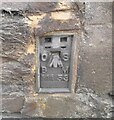
Ordnance Survey Flush Bracket (11153)
This OS Flush Bracket can be found on Penmaenucha Farm. It marks a point 15.780m above mean sea level.
Image: © Adrian Dust
Taken: 15 Oct 2022
0.02 miles
2
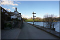
The George III Hotel at Penmaenpool
Viewed from the site of Penmaenpool station.
Image: © John Lucas
Taken: 31 Mar 2022
0.03 miles
3
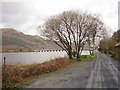
Looking back towards Penmaenpool
Taken during a walk along the Mawddach Trail. For more information about this walk, see Image
Image: © John Lucas
Taken: 17 Dec 2008
0.05 miles
4
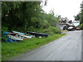
Cottage and boats beside the path near Penmaenpool
A newly refurbished or built cottage stands beside the path and a few rather unseaworthy looking boats lie nearby.
Image: © Jeremy Bolwell
Taken: 16 Jun 2011
0.05 miles
5
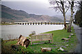
Seat with a view
Looking out over Afon Mawddach and the Penmaenpool toll bridge. Beside the Mawddach Trail.
Image: © John Lucas
Taken: 17 Mar 2022
0.06 miles
6
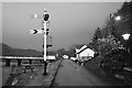
Semaphore signal at Penmaenpool
Signal at the site of Penmaenpool station on the former Ruabon - Barmouth line, closed to all traffic on 12th December 1964 following flood damage. Part of the line was reopened later that month, but then passenger services ceased as planned under the Beeching axe on 18th January 1965. Part of the line has been preserved as a standard gauge steam railway between Llangollen and Corwen, and another section is operated as the narrow gauge Bala Lake Railway. The section pictured here is used as the Mawddach Trail, a cycleway and footpath between Barmouth Junction and Dolgellau.
The picture shows the stationmaster's house on the right of the shot.Also visible is part of Penmaenpool toll bridge and the bridge keeper's hut, and immediately to its right and partially obscured by a tree, the former signal box, now converted into an information centre.
Image: © John Winder
Taken: 31 Dec 2015
0.06 miles
7
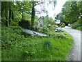
Property beside the Mawddach Trail at Penamenpool
A cottage with a few boats, still.
Image: © Jeremy Bolwell
Taken: 31 May 2021
0.06 miles
8
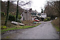
Site of Penmaenpool engine shed alongside the Mawddach Trail
The nearest house is built on the site of the shed, which was a small two-road building, constructed of timber but latterly protected by corrugated sheeting. The further house was of railway origin, presumably to house railway staff in this somewhat isolated location. A photograph taken from an almost identical position shows the shed in 1970, 5 years after closure: http://www.archive-images.co.uk/gallery/Archive-Colour-Images-of-Caernarvonshire-Railways/image/115/Penmaenpool_Railway_Station_c1970.
Although later becoming part of the GWR empire, the station at Penmaenpool was originally constructed by the Aberystwith and Welsh Coast Railway (A&WCR) on its branch from Barmouth Junction station to Dolgellau. The A&WCR was a constituent of the Cambrian Railway and the shed was used to service its locomotives using its station at Dolgellau, which had an end-on junction with the GWR route from Ruabon. Later, the line became very busy on summer Saturdays, with holiday specials heading from the midlands to the Welsh coast resorts.
Interestingly, the post-mounted power supply sub-station shown in the 1970 photograph survives in the same location and can just be seen in my photograph.
Image: © John Lucas
Taken: 17 Mar 2022
0.06 miles
9
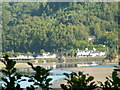
George III
Pub and restaurant at Penmaenpool, at one time a railway station was on the site.
Image: © alan fairweather
Taken: 9 Sep 2006
0.06 miles
10
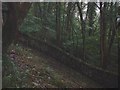
Old Penmaenuchaf Estate Boundary Wall
This photograph shows an old dry stone wall that once formed a boundary to the Penmaenuchaf Estate in Penmaenpool, Gwynedd. Through the trees and to the east of the boundary wall is the village of Penmaenpool on the Mawddach Estuary. Detailed maps show the nearest building to be Penmaen Cottage.
The wall which I can confirm being at least 10 feet tall, is a defining boundary line and also, since it climbs steeply around the bottom of Ffridd-y-Mynydd cliff (behind photographer), a lasting testimony to the skill of the dry stone wall builder.
There is some more information on the history of the Penmaenuchaf Estate on my family's website http://homepage.ntlworld.com/judy.whitby/penmaenucha/pen%20toc.htm
Image: © Mr G Whitby
Taken: 6 Oct 2004
0.07 miles