
IMAGES TAKEN NEAR TO
ARTHOG, LL39 1YU
Introduction
This page details the photographs taken nearby to LL39 1YU by members of the Geograph project.
The Geograph project started in 2005 with the aim of publishing, organising and preserving representative images for every square kilometre of Great Britain, Ireland and the Isle of Man.

There are currently over 7.5m images from over14,400 individuals and you can help contribute to the project by visiting https://www.geograph.org.uk
Image Map
Images are licensed for reuse under creativecommons.org/licenses/by-sa/2.0
Notes
- Clicking on the map will re-center to the selected point.
- The higher the marker number, the further away the image location is from the centre of the postcode.
Image Listing (50 Images Found)
Images are licensed for reuse under creativecommons.org/licenses/by-sa/2.0
Image
Details
Distance
1
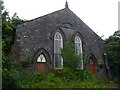
Old chapel in Arthog
Sion chapel, dated 1863 or 1865. Destined for conversion to a residence maybe?
Image: © Jeremy Bolwell
Taken: 16 Jul 2012
0.03 miles

3

Arthog
A small village on the southern side of the Mawddach River, well known for its outdoor activity centres.
Image: © Eirian Evans
Taken: 10 May 2012
0.05 miles
4
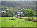
Sheep grazing in the flood plain at Arthog
The area between the abandoned railway line from Dolgellau to Abermaw/Barmouth and the coastal road (A493) is protected from regular flooding. However, these fields are part of the flood plain of the Mawddach estuary and are drained by a number of drainage ditches. The houses are at the centre of the village of Arthog.
Image: © Rudi Winter
Taken: 20 Apr 2011
0.05 miles
5

Arthog from the bridge
Looking towards Arthog village from the former railway bridge on the Mawddach Trail. The afon Arthog is obviously tidal upstream of the bridge and the sea wall runs to its right. The houses to the right are in Arthog Terrace. Taken at 1528 - low water at Barmouth was 1715 on this day.
Image: © E Gammie
Taken: 11 May 2009
0.05 miles
6

Arthog from the Mawddach Trail
The view looks south east from the bridge next to the site of the former Arthog Station.
Image: © Trevor Harris
Taken: 30 Jul 2009
0.06 miles


9

Path to Arthog Falls
The path climbs through a fine sessile oak wood past a series of waterfalls.
Image: © Gordon Hatton
Taken: Unknown
0.07 miles
10

Arthog
seen from the trackbed of the railway between Barmouth Junction (Morfa Mawddach) and Dolgellau
Image: © Andrew Longton
Taken: 28 Aug 1996
0.07 miles