
IMAGES TAKEN NEAR TO
ARTHOG, LL39 1YP
Introduction
This page details the photographs taken nearby to LL39 1YP by members of the Geograph project.
The Geograph project started in 2005 with the aim of publishing, organising and preserving representative images for every square kilometre of Great Britain, Ireland and the Isle of Man.

There are currently over 7.5m images from over14,400 individuals and you can help contribute to the project by visiting https://www.geograph.org.uk
Image Map
Images are licensed for reuse under creativecommons.org/licenses/by-sa/2.0
Notes
- Clicking on the map will re-center to the selected point.
- The higher the marker number, the further away the image location is from the centre of the postcode.
Image Listing (48 Images Found)
Images are licensed for reuse under creativecommons.org/licenses/by-sa/2.0
Image
Details
Distance

2
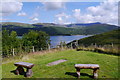
View across the Mawddach Estuary from the touring site at Graig Wen
Image: © Phil Champion
Taken: 15 Jul 2014
0.03 miles
3
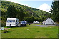
The touring caravan and upper camping area at Graig Wen
Image: © Phil Champion
Taken: 15 Jul 2014
0.03 miles
4
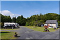
Touring camping and caravan site at Graig Wen
A small site with hard standings and some space for tents. There are also a number of camping pitches in the fields below, accessed by a long steep track.
Image: © Phil Champion
Taken: 15 Jul 2014
0.03 miles
5
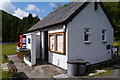
Toilet block at Graig Wen
Showers at this campsite are located in another building.
Image: © Phil Champion
Taken: 15 Jul 2014
0.04 miles
6

Recycling facilities at the campsite at Graig Wen
Image: © Phil Champion
Taken: 15 Jul 2014
0.04 miles
7
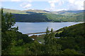
View towards the Mawddach Estuary from Graig Wen
Image: © Phil Champion
Taken: 15 Jul 2014
0.04 miles
8
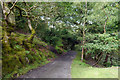
Track down to the lower camping fields at Graig Wen
The campsite at Graig Wen comprises a small touring site near the road, with toilet and shower facilities, and a number of pitches in fields closer to the Mawddach estuary. There is a long steep track connecting the two areas
Image: © Phil Champion
Taken: 15 Jul 2014
0.05 miles
9

Ordnance Survey Cut Mark
This OS cut mark can be found on the old abutment SE side of the road. It marks a point 65.958m above mean sea level.
Image: © Adrian Dust
Taken: 15 Oct 2022
0.07 miles
