IMAGES TAKEN NEAR TO
LLWYNGWRIL, LL37 2YQ
Introduction
This page details the photographs taken nearby to LL37 2YQ by members of the Geograph project.
The Geograph project started in 2005 with the aim of publishing, organising and preserving representative images for every square kilometre of Great Britain, Ireland and the Isle of Man.

There are currently over 7.5m images from over14,400 individuals and you can help contribute to the project by visiting https://www.geograph.org.uk
Image Map
Images are licensed for reuse under creativecommons.org/licenses/by-sa/2.0
Notes
- Clicking on the map will re-center to the selected point.
- The higher the marker number, the further away the image location is from the centre of the postcode.
Image Listing (58 Images Found)
Images are licensed for reuse under creativecommons.org/licenses/by-sa/2.0
Image
Details
Distance
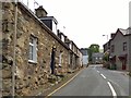
1
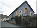
Chapel, at the side of the A493, Llwyngwril
Image: © Roger Cornfoot
Taken: 17 Jul 2009
0.01 miles
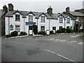
2
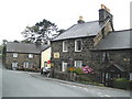
Garthangharad Pub and Restaurant
17th C coaching inn in the heart of the village, but seems to be closed.
Image: © Eirian Evans
Taken: 19 Mar 2019
0.01 miles
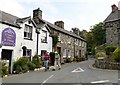
5
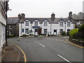
Garthangharad Hotel
Garthangharad Hotel in the village of Llwyngwril.
Image: © Philip Halling
Taken: 24 Jun 2021
0.02 miles
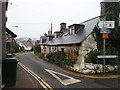
9
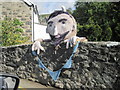
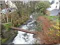
"Yarn-bombing" on the bridge at Llwyngwril
Image: © Nigel Thompson
Taken: 12 Sep 2015
0.03 miles