
IMAGES TAKEN NEAR TO
LLWYNGWRIL, LL37 2QF
Introduction
This page details the photographs taken nearby to LL37 2QF by members of the Geograph project.
The Geograph project started in 2005 with the aim of publishing, organising and preserving representative images for every square kilometre of Great Britain, Ireland and the Isle of Man.

There are currently over 7.5m images from over14,400 individuals and you can help contribute to the project by visiting https://www.geograph.org.uk
Image Map
Images are licensed for reuse under creativecommons.org/licenses/by-sa/2.0
Notes
- Clicking on the map will re-center to the selected point.
- The higher the marker number, the further away the image location is from the centre of the postcode.
Image Listing (18 Images Found)
Images are licensed for reuse under creativecommons.org/licenses/by-sa/2.0
Image
Details
Distance
1
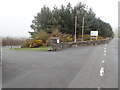
Sun Beach Caravan Park
Entrance to the park.
Image: © Eirian Evans
Taken: 19 Mar 2019
0.07 miles
2
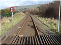
The Cambrian Coast rail line
Looking north from the level crossing of the road into the Sun Beach caravan park (having first checked carefully that there wasn't anything coming, obviously)
Image: © Richard Law
Taken: 4 Mar 2014
0.11 miles
4
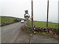
By the A493 south of Llwyngwril
A couple of interesting items here - the chair with a crocheted cover impaled on the telegraph pole, and my reflection caught in the mirror. They are by a track going down to a house. In 2015, the villagers of Llwyngwril began an art project (yarn bombing) creating knitted and crocheted animals, figures and the legendary Gwril giant to decorate the village. The purpose of the project was to bring the community together to raise funds for Y Canolfan (Llwyngwril Community Centre).
Image: © Eirian Evans
Taken: 19 Mar 2019
0.14 miles
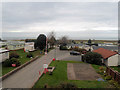
6
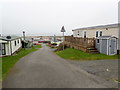
Sun Beach Caravan Park
Much as I dislike static caravan parks, this is much better than the green monstrosities at Tywyn.
Image: © Eirian Evans
Taken: 19 Mar 2019
0.16 miles
8
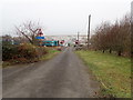
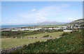
Steeply downhill
The slope of the land is totally lost in the photo; this is the view down the steep lane that leads up beside the Nant Geseiliog from the A463 coast road, with the Sun Beach caravan park on the flats beyond.
Image: © Richard Law
Taken: 4 Mar 2014
0.17 miles
9
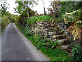
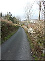
Ancient steps
These steps form part of the Wales Coast footpath. The official path climbs the hill and meanders across some countryside before descending into Llwyngwril by another minor road. I chose a shorter route by descending down this road, behind the camera, to join the A493 and then a walk of about a kilometre (which mostly has no pavement so one has to 'mix it' with road traffic) into Llwyngwril.
Image: © John Lucas
Taken: 19 Oct 2015
0.18 miles
10
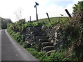
Steps up the road dyke
The Wales Coast Path leaves the lane at this point, goes over the stile and heads south.
Image: © John Haynes
Taken: 21 May 2012
0.18 miles