
IMAGES TAKEN NEAR TO
Bryncrug, TYWYN, LL36 9UN
Introduction
This page details the photographs taken nearby to LL36 9UN by members of the Geograph project.
The Geograph project started in 2005 with the aim of publishing, organising and preserving representative images for every square kilometre of Great Britain, Ireland and the Isle of Man.

There are currently over 7.5m images from over14,400 individuals and you can help contribute to the project by visiting https://www.geograph.org.uk
Image Map
Images are licensed for reuse under creativecommons.org/licenses/by-sa/2.0
Notes
- Clicking on the map will re-center to the selected point.
- The higher the marker number, the further away the image location is from the centre of the postcode.
Image Listing (9 Images Found)
Images are licensed for reuse under creativecommons.org/licenses/by-sa/2.0
Image
Details
Distance
1
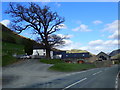
Dol-dehewydd
Farm on the roadside between Dolgoch and Bryncrug.
Image: © Eirian Evans
Taken: 26 Mar 2019
0.04 miles
2
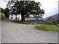
Dol-deheuwydd.
Some of the farm buildings have been tastefully converted to holiday let units, a sign of the times on many modern farms.
Image: © Hefin Richards
Taken: 13 Sep 2006
0.06 miles
3
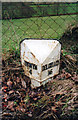
Old Milepost by the B4405, Bryn Crug parish
Milepost by the B4405, in parish of Bryn Crug (Gwynedd District), Bryn Crug, East of Dol-Deheuwydd.
Inscription reads:-
: TOWYN / 4 : : DOLGELLEY / 16 :
Grade II Listed by Cadw.
Reference Number: 23897 https://cadwpublic-api.azurewebsites.net/reports/listedbuilding/FullReport?lang=&id=23897
To be surveyed
Milestone Society National ID: MER_TWDG04.
Image: © Milestone Society
Taken: Unknown
0.15 miles
4
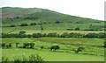
Confluence of stream and river, west of Dolgoch
The river is lined with trees, the stream has none.
Image: © Christine Johnstone
Taken: 20 Jun 2016
0.18 miles
5
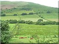
Farmland with parallel drains, valley of Afon Fathew
The cattle are not grazing in the damp valley bottom, but on the lowest slopes of Fridd Llwyn hynydd.
Image: © Christine Johnstone
Taken: 20 Jun 2016
0.19 miles
6
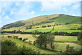
Towards Foel Wyllt
A view over the Fathew valley towards the fields and moorland of Foel Wyllt.
Image: © Des Blenkinsopp
Taken: 5 Aug 2019
0.19 miles
7
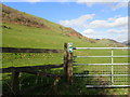
Footpath to Llanerch Goediog
A gentle footpath on the lower slopes of Foell Wyllt
Image: © Eirian Evans
Taken: 26 Mar 2019
0.22 miles
8
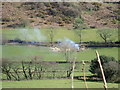
Felling and clearing trees near the Talyllyn railway line
Image: © Eirian Evans
Taken: 26 Mar 2019
0.22 miles
9
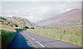
NE up valley of Afon Fathew on B4405 near Dolgoch, 1962
View NE going towards Talyllyn Lake and mountain fastness beyond.
Image: © Ben Brooksbank
Taken: 2 Jun 1962
0.24 miles