
IMAGES TAKEN NEAR TO
Bryncrug, TYWYN, LL36 9UH
Introduction
This page details the photographs taken nearby to LL36 9UH by members of the Geograph project.
The Geograph project started in 2005 with the aim of publishing, organising and preserving representative images for every square kilometre of Great Britain, Ireland and the Isle of Man.

There are currently over 7.5m images from over14,400 individuals and you can help contribute to the project by visiting https://www.geograph.org.uk
Image Map
Images are licensed for reuse under creativecommons.org/licenses/by-sa/2.0
Notes
- Clicking on the map will re-center to the selected point.
- The higher the marker number, the further away the image location is from the centre of the postcode.
Image Listing (5 Images Found)
Images are licensed for reuse under creativecommons.org/licenses/by-sa/2.0
Image
Details
Distance
1

Snowdonian barn
Although typical of barns found throughout North Wales, there are endless variations in size, nature and detail. This one is bigger than most. Having my Yamaha parked inside it gives you an idea of just how big it is. They obviously don't all share this one's distinct list to starboard.
Image: © mike morley
Taken: 27 Aug 2010
0.03 miles
2
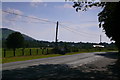
B4405 ger Bryncrug / B4405 near Bryncrug
Image: © Ian Medcalf
Taken: 23 Jul 2014
0.15 miles
3
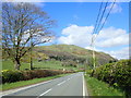
The road to Abergynolwyn from Bryncrug
The B4405 goes up the valley of Afon Fathew, with Foel Wyllt rising ahead.
Image: © Eirian Evans
Taken: 26 Mar 2019
0.19 miles
4
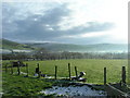
Winter sun on the fields east of Bryncrug
Image: © James Ayres
Taken: 19 Dec 2009
0.22 miles
5
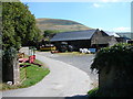
Farm buildings at Dolaugwyn
Some ancient buildings at Dolaugwyn farm. This is a site of historical importance and is consequently marked in 'antique' style lettering on the OS map.
Image: © John Lucas
Taken: 3 Aug 2006
0.22 miles