IMAGES TAKEN NEAR TO
TYWYN, LL36 9RY
Introduction
This page details the photographs taken nearby to LL36 9RY by members of the Geograph project.
The Geograph project started in 2005 with the aim of publishing, organising and preserving representative images for every square kilometre of Great Britain, Ireland and the Isle of Man.

There are currently over 7.5m images from over14,400 individuals and you can help contribute to the project by visiting https://www.geograph.org.uk
Image Map
Images are licensed for reuse under creativecommons.org/licenses/by-sa/2.0
Notes
- Clicking on the map will re-center to the selected point.
- The higher the marker number, the further away the image location is from the centre of the postcode.
Image Listing (20 Images Found)
Images are licensed for reuse under creativecommons.org/licenses/by-sa/2.0
Image
Details
Distance
1
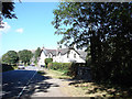
Ysguboriau Farmhouse
In addition to farming, the Ysguboriau estate runs a large camping and caravan site on the opposite side of the road.
Image: © John Lucas
Taken: 3 Aug 2006
0.01 miles
2
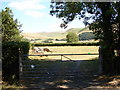
Farm Gate beside the A493
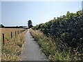
Between Bryncrug and Tywyn
Image: © John Lucas
Taken: 3 Aug 2006
0.02 miles
3
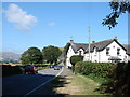
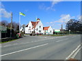
Farmhouse at Ysguboriau
This farmhouse stands beside the A493 road between Bryncrug and Tywyn.
Image: © John Lucas
Taken: 3 Aug 2006
0.04 miles
4
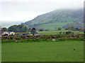
Ysguboriau
A farmstead north-east of Tywyn.
Image: © John Lucas
Taken: 15 May 2018
0.06 miles
5
Ordnance Survey Pivot
This OS pivot can be found on the north angle of the barn at Ysguboriau Farm. It marks a point 8.432m above mean sea level.
Image: © Adrian Dust
Taken: 17 Oct 2022
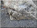
0.06 miles
6
Welsh Black cattle at Ysguboriau
These four need a good bath before they are show ready!
Image: © Eirian Evans
Taken: 26 Mar 2019
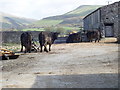
0.08 miles
8
Coat of Arms at Ynysmaengwyn
On the entrance gateposts, the coat of arms of John Corbett (1817-1901) who bought the property in 1878, who was a wealthy salt merchant who owned the Stoke Prior Salt Works near Droitwich, was Liberal M.P. for Droitwich between 1874 and 1885 and the Liberal Unionist M.P. for Mid-Worcestershire between 1886-1892. In Droitwich he was known as The Salt King. He did not live at Ynysymaengwyn on a permanent basis, although his wife moved there with their children.
Image: © Eirian Evans
Taken: 26 Mar 2019
0.12 miles
10
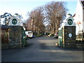
Ynysymaengwyn Gateway.
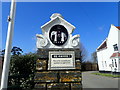
Looking straight down the drive past the lodge. http://www.ynysy.co.uk/
Image: © Hefin Richards
Taken: 3 Mar 2007
0.13 miles