IMAGES TAKEN NEAR TO
Pentre Uchaf, TYWYN, LL36 9PN
Introduction
This page details the photographs taken nearby to Pentre Uchaf, LL36 9PN by members of the Geograph project.
The Geograph project started in 2005 with the aim of publishing, organising and preserving representative images for every square kilometre of Great Britain, Ireland and the Isle of Man.

There are currently over 7.5m images from over14,400 individuals and you can help contribute to the project by visiting https://www.geograph.org.uk
Image Map
Images are licensed for reuse under creativecommons.org/licenses/by-sa/2.0
Notes
- Clicking on the map will re-center to the selected point.
- The higher the marker number, the further away the image location is from the centre of the postcode.
Image Listing (20 Images Found)
Images are licensed for reuse under creativecommons.org/licenses/by-sa/2.0
Image
Details
Distance
2
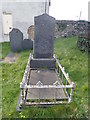
The grave of Mary Jones
In the year 1800 Mary Jones at the age of 16 walked from Llanfihangel-y-Pennant to Bala to procure a copy of a Welsh Bible from the Rev. Thomas Charles B.A. This incident led to the formation of the British and Foreign Bible Society. The monument was erected by subscription from the Sunday Schools of Merionethshire.
Image: © Eirian Evans
Taken: 26 Mar 2019
0.09 miles
3
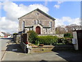
Capel Bethlehem, Bryncrug
Calvinist Methodist chapel, built in 1800 and enlarged in 1841. It is here that Mary Jones is buried, who in 1800 at the age of 16 walked from Llanfihangel-y-Pennant to Bala to procure a copy of a Welsh Bible from the Rev. Thomas Charles. This incident led to the formation of the British and Foreign Bible Society.
Image: © Eirian Evans
Taken: 26 Mar 2019
0.10 miles
4
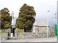
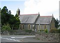
Bryncrug Church
Church in the village of Bryncrug just to the North of Tywyn, Gwynedd.
Image: © Cered
Taken: 8 Apr 2006
0.12 miles
5
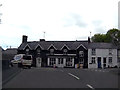
The A493 road running through Bryncrug
The minor road on the right connects with the B4405 road which leads to Llyn Tal-y-llyn.
Image: © John Lucas
Taken: 26 May 2016
0.13 miles
6
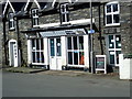
Bryncrug Village Store
Now closed, just selling logs.
Image: © Eirian Evans
Taken: 26 Mar 2019
0.13 miles
7
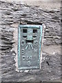
Ordnance Survey Flush Bracket (S0341)
This OS Flush Bracket can be found on the south face of Pontfethen House. It marks a point 7.279m above mean sea level.
Image: © Adrian Dust
Taken: 26 Jul 2015
0.14 miles
9
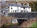
Bridge at Bryncrug
Bridge taking the A493 road over the river at Bryncrug.
Image: © Cered
Taken: 8 Apr 2006
0.14 miles