
IMAGES TAKEN NEAR TO
Llanegryn, TYWYN, LL36 9NL
Introduction
This page details the photographs taken nearby to LL36 9NL by members of the Geograph project.
The Geograph project started in 2005 with the aim of publishing, organising and preserving representative images for every square kilometre of Great Britain, Ireland and the Isle of Man.

There are currently over 7.5m images from over14,400 individuals and you can help contribute to the project by visiting https://www.geograph.org.uk
Image Map
Images are licensed for reuse under creativecommons.org/licenses/by-sa/2.0
Notes
- Clicking on the map will re-center to the selected point.
- The higher the marker number, the further away the image location is from the centre of the postcode.
Image Listing (5 Images Found)
Images are licensed for reuse under creativecommons.org/licenses/by-sa/2.0
Image
Details
Distance
1

View up Dyffryn Dysynni
Looking over Waenfach farm to the valley, with the well-known Birds' Rock / Craig yr Aderyn clearly visible on the right. Cadair Idris and Mynydd Pencoed form the left skyline.
Image: © Nigel Brown
Taken: 4 Mar 2010
0.04 miles
2
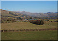
Grazing land near Ty-bach-y-ffordd
Situated on a flat offshoot of the Dysynni valley. Cadair Idris can be seen in the distance.
Image: © Nigel Brown
Taken: 4 Mar 2010
0.06 miles
3

Undulating Roof.
Farm buildings at Ty Bach Y Ffordd.
Image: © Hefin Richards
Taken: 13 Sep 2006
0.08 miles
4
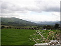
Green Fields.
Looking across lush fields, Craig Yr Aderyn (Bird Rock) can be seen just to right of the photograph.
Image: © Hefin Richards
Taken: 13 Sep 2006
0.16 miles
5
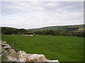
Feeding time.
A farmer feeds his sheep on fields near Castell Mawr. The village of Rhoslefain can be seen in the distance.
Image: © Hefin Richards
Taken: 13 Sep 2006
0.25 miles